Partisan. Say it up front. I think ice moved the big stones of Britain about and people stood them up, and I thought so before the geology got interesting. So read what follows as a man with a side and a map.
The occasion is a new paper on the Devil’s Arrows, the Millstone Grit monoliths beside the A1 at Boroughbridge, North Yorkshire. Put up something like 4,000 years ago (BC 2,000). The paper matches their zircons to Brimham Rocks, a crag 18 km west, and concludes that Bronze Age people picked that crag on purpose and dragged the stones eleven miles to a spot with no gritstone of its own. Deliberate sourcing. The word is in the title.
Yellow: the Kinderscoutian sandstone the Arrows were matched to, traced from the BGS 1:50k map. Brimham Rocks is inside it, and so is a lot of other ground. Blue: the Devensian glacial lake, the Arrows on its west shore. The lake is rough, from the BGS Lexicon limits; the grit outline is raster-traced from a filtered BGS map image, not BGS vector data, and the filter picks one mapping name, so equivalent rock mapped under other names is left out. Contains British Geological Survey materials (c) UKRI 2026. Spin it round yourself in Google Earth.Continue reading “Different special”
Artist first. Geology A level a distant third, and that was forty-five years ago. What follows was worked out in conversation with an AI, then checked against the documents. Where the checking ran out, I say so.
They complained. Traffic past Stonehenge was glacial, they said, all because drivers slow down for a gawp at the stones. Little did they know. Four hundred and fifty thousand years ago the whole queue might have been sitting under an ice sheet. Might. Hold on to that word; it does all the work in this post.
So they decided to build a tunnel. Under a UNESCO World Heritage Site. You cannot just dig; you have to check the buried history first. So they dug, and drilled, and augered, and trenched. Seven hundred times.
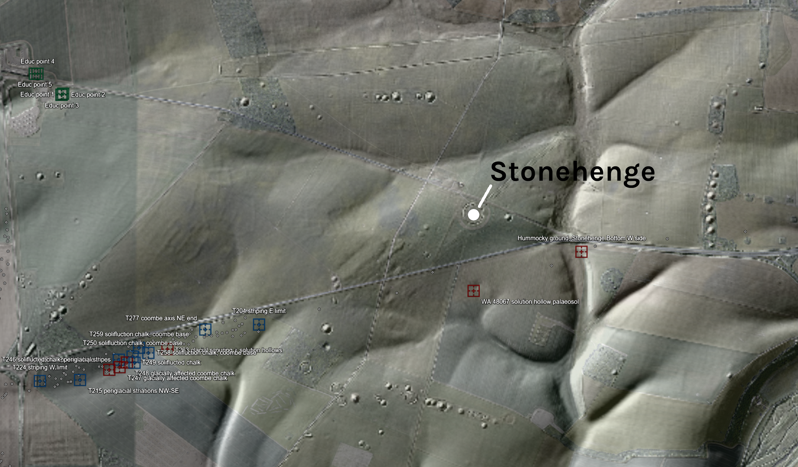
The survey area under LiDAR, gazetteer sites overlaid. LIDAR: (c) Environment Agency copyright and/or database right 2026, Open Government Licence. Imagery (c) 2026 Google.
The picture above is the whole area under LiDAR, low sun from the north-west, every bump on Salisbury Plain standing to attention. The coloured squares are my gazetteer. Red for the primary records. Blue for trenches where the diggers wrote cold-climate words on their sheets. Grey for a line of auger holes, green for a 2023 evaluation by the visitor centre, purple for a borehole transect, orange for four drilled cores that went off to a laboratory and never came back. All of it lives in a Google Earth file you can spin round yourself. Turn the layers on and off. Fly about. It is the best free toy I have made all year.
I have read the lot. Forty-three public documents, 11,302 pages of borehole logs, trench sheets, laboratory appendices and method statements, put through a scanner with one question: ‘did anybody, anywhere along that road, record anything glacial?’ All from one road scheme, mind; Historic England’s own archive is another trawl for another day. What came back is not proof. Hints. But damn, some of them are suspicious.
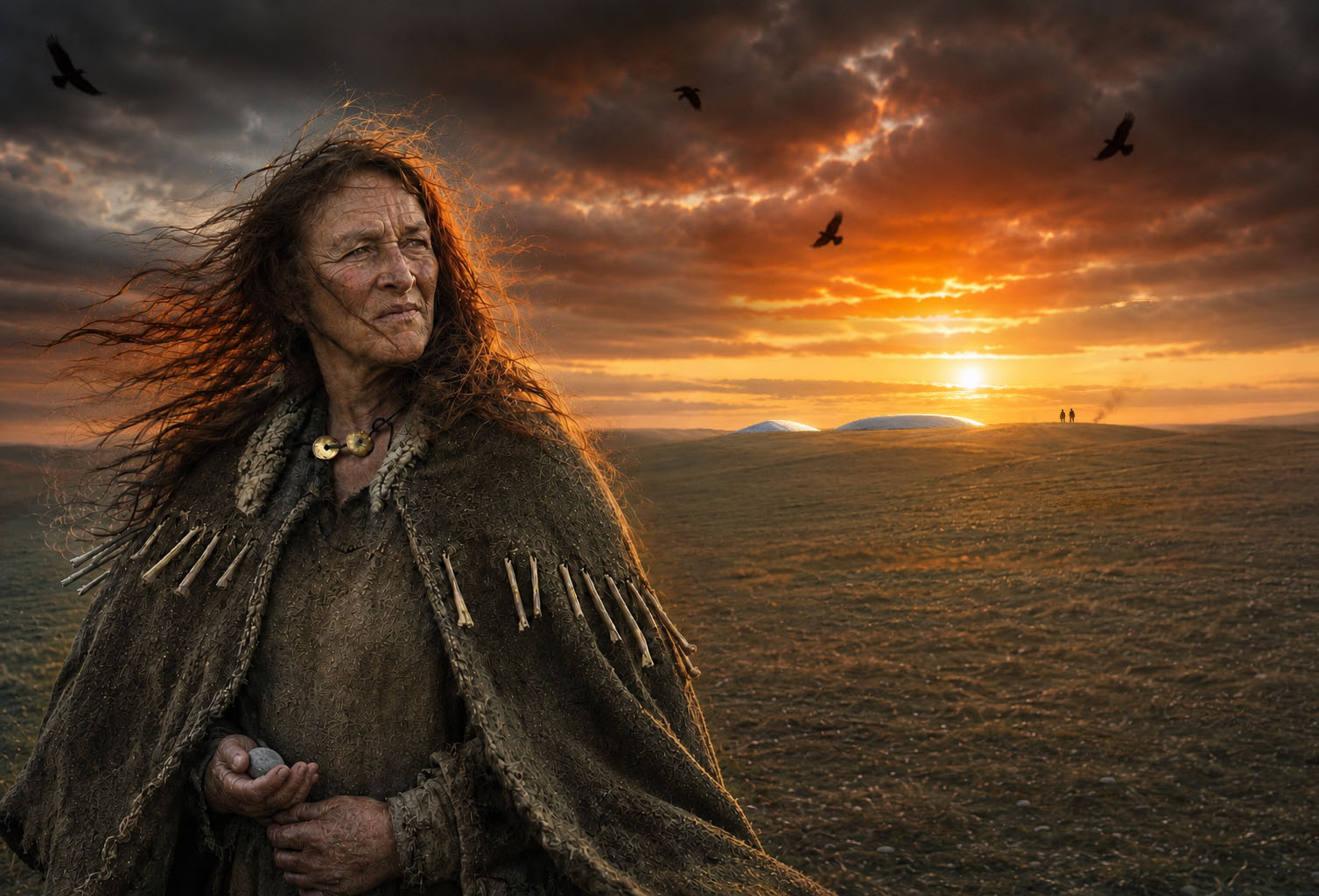
The Upton Lovell woman, as a witch photographer would. The single fringe of drilled bone points, the two hammered gold discs, the dark touchstone in her palm and the raw white chalk of the barrows behind her all come from the record.
Well, well, well. The Upton Lovell shaman, dug out of a Wiltshire barrow in the early 1800s and shown off ever since as a bearded bloke in a bone cloak, turns out to have been a woman – a shamanka. Ancient DNA, three separate bones, the same answer each time. She lived around 3,800 ya (BC 1,800), and she was buried barely 10 miles (16km) west of Stonehenge.
Derived from the Tungusic word šaman meaning “one who knows” a shamanka is a female shaman. The word combines the term “shaman” with the Russian feminine suffix “-ka.”