Artist first. Geology A level a distant third, and that was forty-five years ago. What follows was worked out in conversation with an AI, then checked against the documents. Where the checking ran out, I say so.
It is a reply to Brian John, who picked up my Glacial A303 post, and then answered a question I put to him. His answer changed what I think is worth asking for.
About that barrel
In the first post I got excited about forty litres of possible glacial evidence sitting in an archive. I had even imagined a blue plastic barrel. A label. A lid. On a shelf. Pulsing with canned excitement.
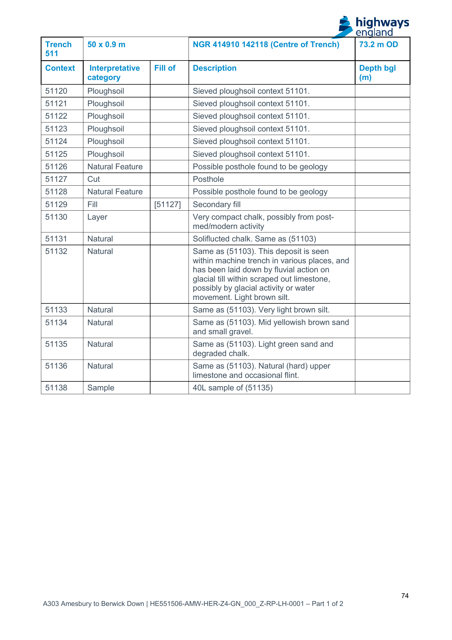
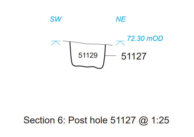
The record did not support it. I had read two rows of a context table as one. The “glacial till” wording belongs to context 51132. Sample 51138 came from 51135, the “light green sand and degraded chalk” next door. Same natural sequence, different context. The original post now carries the correction. My name is on it; the mistake is mine to put right.
What Wessex were actually doing
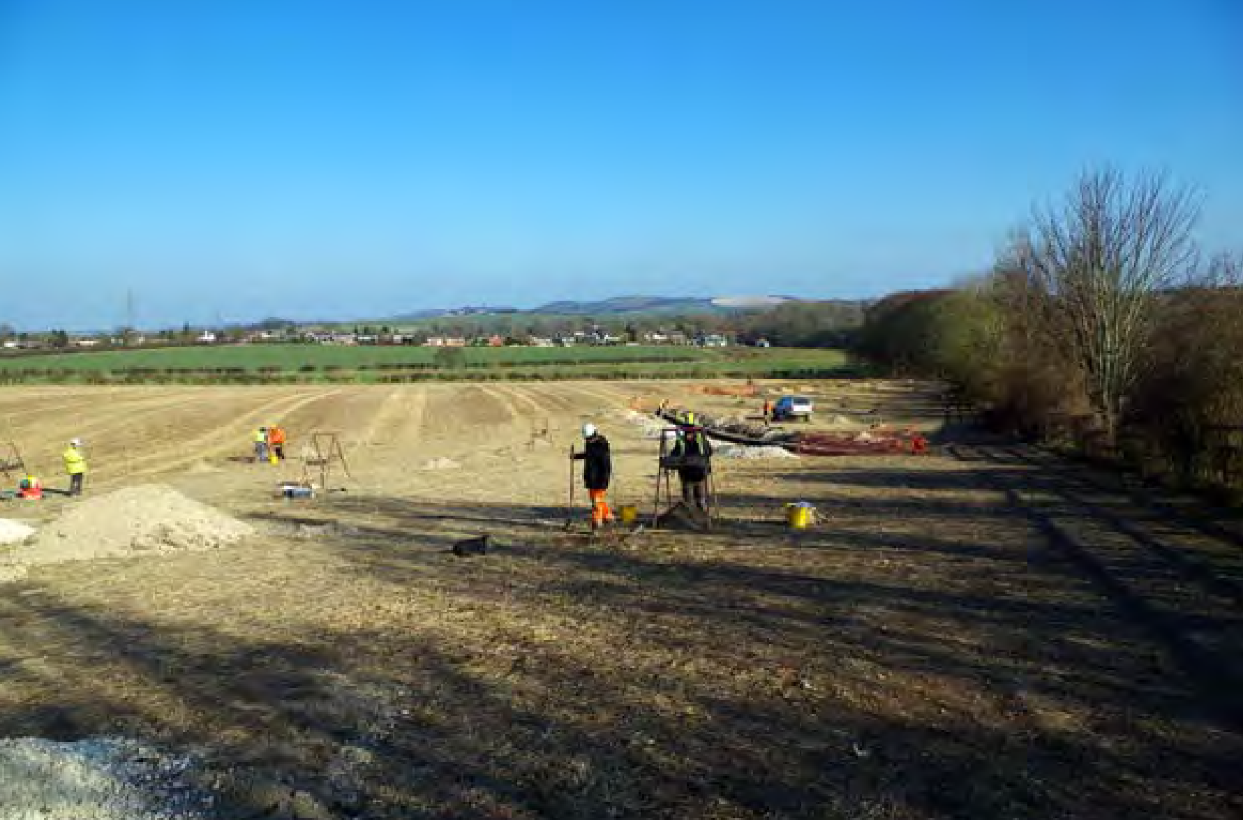
This is the bit I should have led with. Nobody in Trench 511 was looking for a glacier. Wessex Archaeology were testing the ground for a road consent: postholes, pits, ditches, anything Neolithic that a tunnel portal would destroy. Forty litres went into bags from context 51135 so that someone could look for charred seeds and charcoal. That is what environmental samples are for. That was the job.
So, what happened to the forty litres? Thirty-eight of them went through flotation: washed in a tank, the light stuff caught in a fine sieve. That light fraction is the flot. For sample 51138 it came to 10 ml. Two teaspoons. Appendix C, printed p. 85 / PDF p. 86.
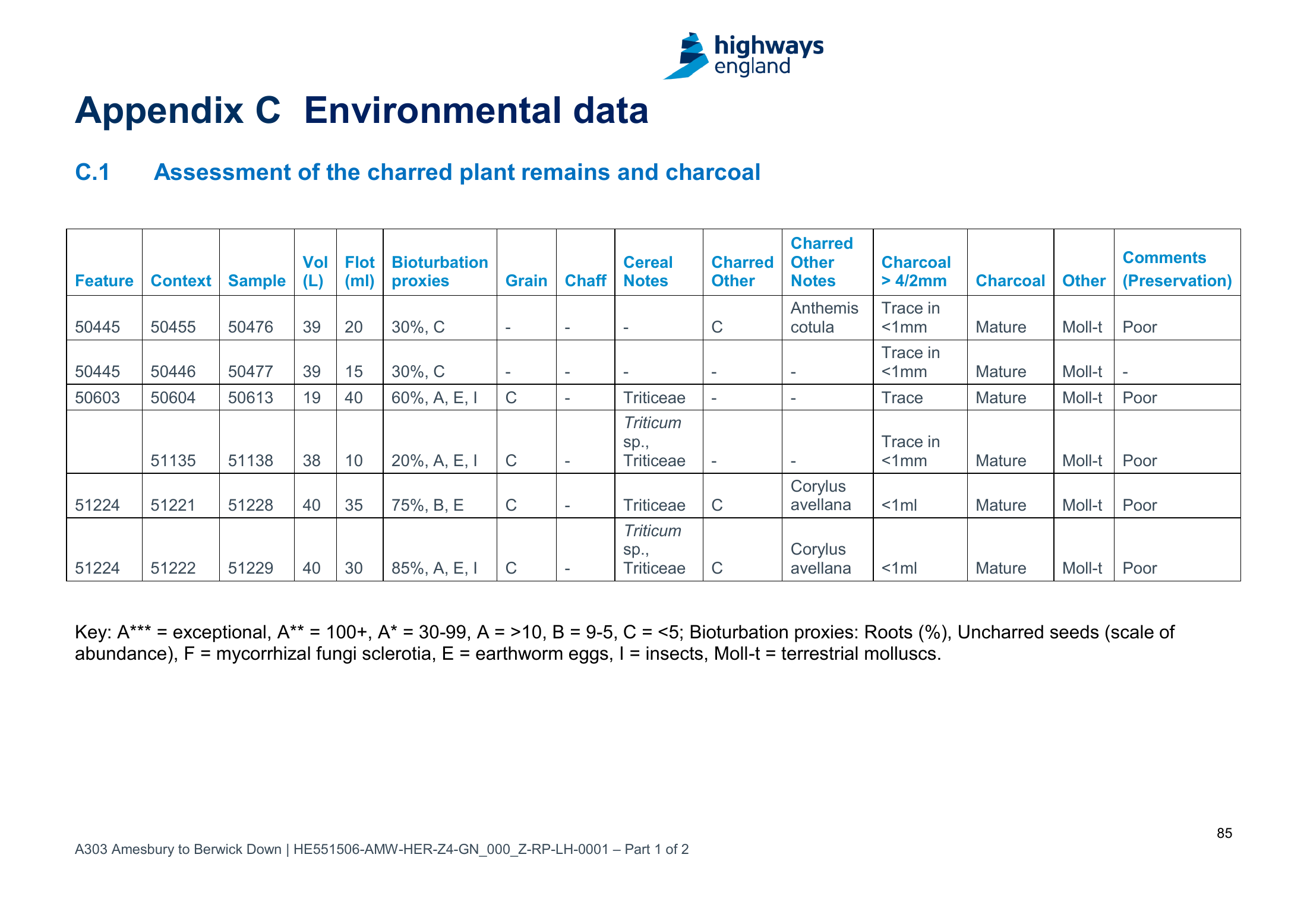
And the heavy stuff? The processing method, printed p. 42 / PDF p. 43, says coarse fractions above 4 mm were sorted, weighed and discarded. Read that again. The pebbles, the clasts, the one part of a bucket of sediment that could tell you what rock it was and where it came from: sorted, weighed, binned. What was kept is the wrong fraction for the question. Whether an exception was made for this sample, the report does not say. Nor does it say what is still on a shelf. Only Wessex can.
No barrel, then. Possibly two teaspoons of flot, a residue bag, a spreadsheet. Ask anyway. But do not build anything on it.
Brian’s test
I asked Brian what might still distinguish a thoroughly degraded till from something that was never till at all, after 450,000 years on chalk. He gave me a list. Cementation, by calcium carbonate or by iron and manganese oxide, though recent deposits cement too if the groundwater is right. Flow structures in a redeposited till. Churning by permafrost over a long period. A stone-supporting matrix shrunk by solution. Clasts rotted, or split by freeze and thaw. Difficult, he said, but not impossible.
Look at that list. Every item on it is about arrangement: how the stones sit in the matrix, what the structures look like, what the cement binds. Every item is destroyed by a spade, a bucket and a flotation tank. So even if all forty litres of 51138 were still sitting unopened, they could never pass Brian’s test. A washed sample has lost its fabric. No amount of enthusiasm puts that back.
Which turns the question round. The bag can tell you, at best, what minerals were in the sand. The ground can tell you how they got there. Only an unwashed section, looked at by someone who knows what old till does on chalk, can answer Brian.
What would a good answer even look like? Not one Preseli grain. Clarke and Kirkland found one of those and, fairly, called it recycled. Ice does not deliver from one address. It scoops from every valley it crosses and dumps the lot in one heap: a Preseli dolerite chip next to a Pembrokeshire sandstone, a shell from the Irish Sea floor, maybe something from the Lake District or the Southern Uplands. Peter Kokelaar has that bag, picked up on the beaches of Gower: Pembrokeshire igneous rock, Ailsa Craig microgranite, Hebridean gneiss, pitchstone from Eigg, all from one ice stream. That is what the glacier carried. The only question is how far east it carried it. A mixed bag from the whole route of the Irish Sea Glacier, 450,000 years ago or 800,000, is the signature to hope for. A mixed bag can also be inherited from some older deposit reworked twice over, so it raises the bar rather than settling anything. But it is the only result that would make a geomorphologist put the kettle on.
A note on that one grain, 11 September 2026
Fair on the grain. Not fair on what they built round it. The paper says its near absence shows that large-scale glacial transport did not occur, which turns four river-sand samples into a negative proof, and it names Preseli when the grain only says Ordovician. Peter Kokelaar, a petrologist who has mapped Anglian erratics on Gower, has taken that paragraph apart line by line on his Stonehenge page, and his closing question is the one that sticks: if one grain does not mean a little ice, what does it mean?
It is also not a one-off. The same Curtin group, Clarke and Kirkland among the authors each time, gave us the 2024 Altar Stone paper and the September 2026 Devil’s Arrows paper, and all three share a shape: a match that only reaches formation level dressed as a pinpoint, ice ruled out by expectation rather than by anything dug up, and human transport in the framing before the data arrives. The longer note is on the A303 page, with Brian John on the Arrows. So: recycled is a reasonable reading of one grain. It is not a verdict on ice.
A thin slice
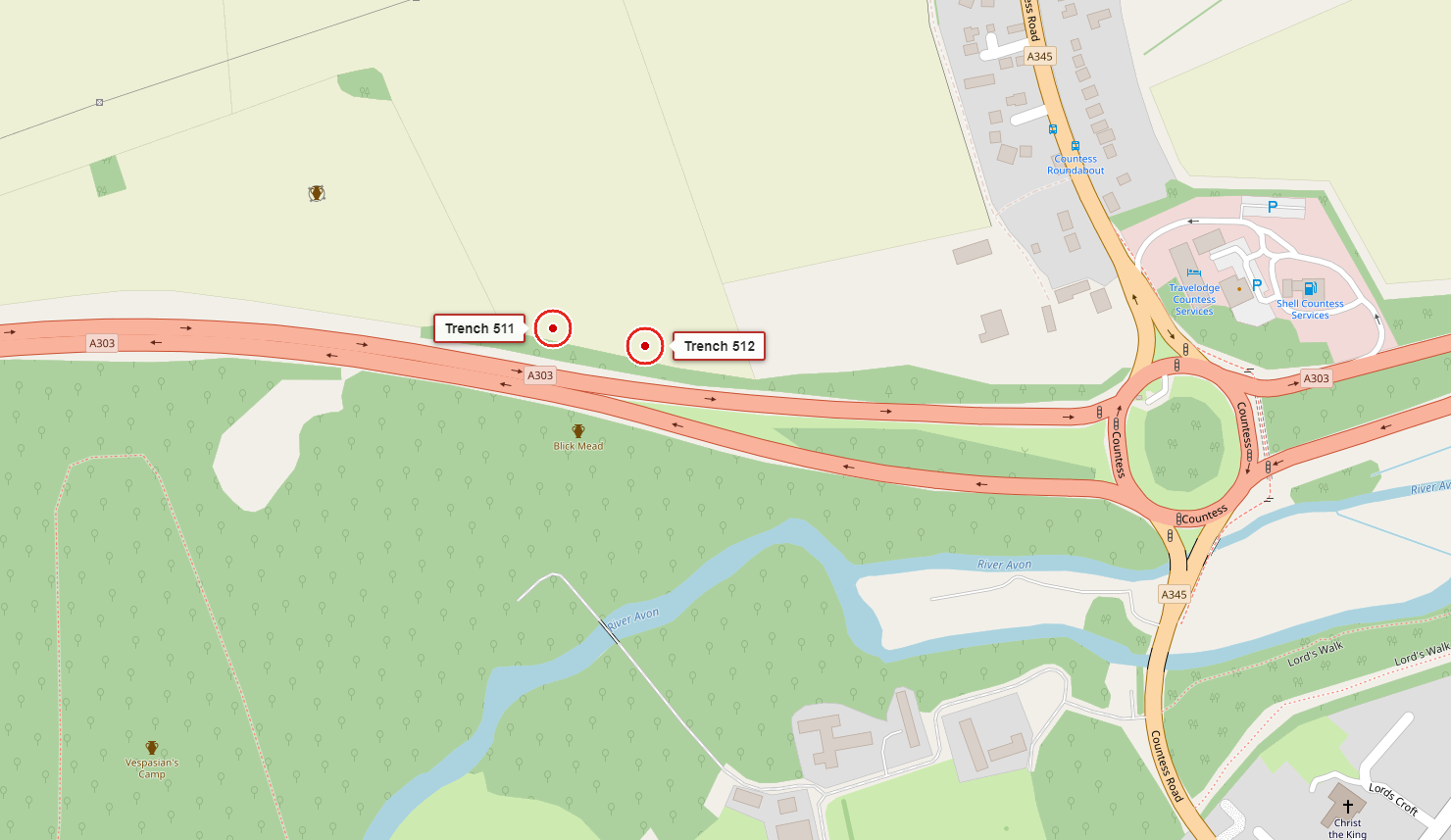
The first post plotted 698 recorded holes and trenches. Sounds enormous. Put them on a map. They sit where a road was going to go, because that is what the road men were paid to test. Between them, beyond them, under fields the carriageway never touched: most of the landscape.
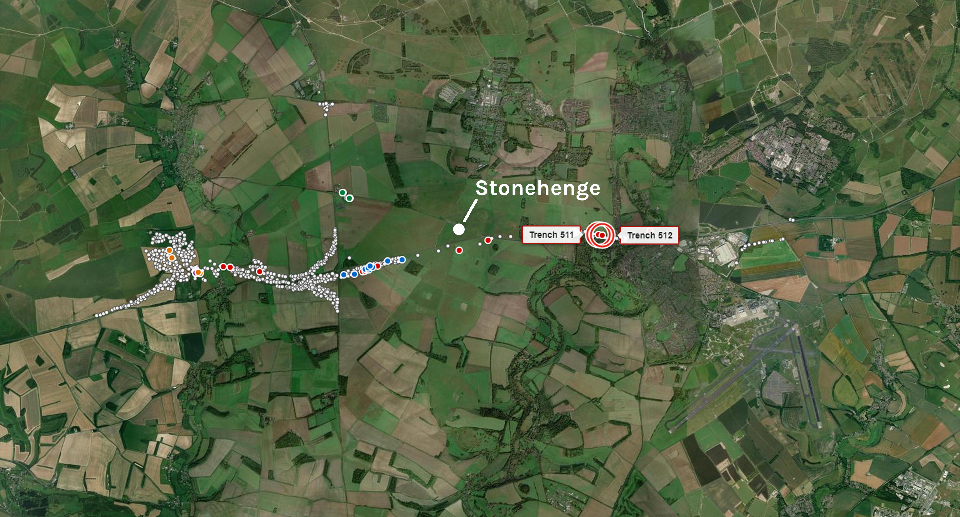
Trench 511 caught my eye because of two words in a table. It has not earned the title of Best Place To Find A Glacier. A geologist may know a far better spot: a deeper coombe fill, a solution hollow that kept its contents, somewhere chosen for the geology rather than the line of a road that was never built.
The ask
Three things, in order of cost.
- Ring Wessex Archaeology. What survives of sample 51138: flot, residue, anything above 4 mm? If nothing, say so and move on.
- Read the Trench 511 field records with Brian’s list in hand. The context sheets may say more about 51132 than the summary table does. Nobody has looked at them for this.
- Find a section. Not necessarily here. Somewhere the natural sequence is exposed or can be exposed, and put someone in front of it who knows what an old till looks like when it has been sat on chalk since the Anglian. That is the only test that answers the question.
If it all turns out to be ordinary local sediment, that counts. If the archive is empty, the conversation moves elsewhere. I can point at the paperwork and make the pictures readable. Somebody with the right hands can take it from here.