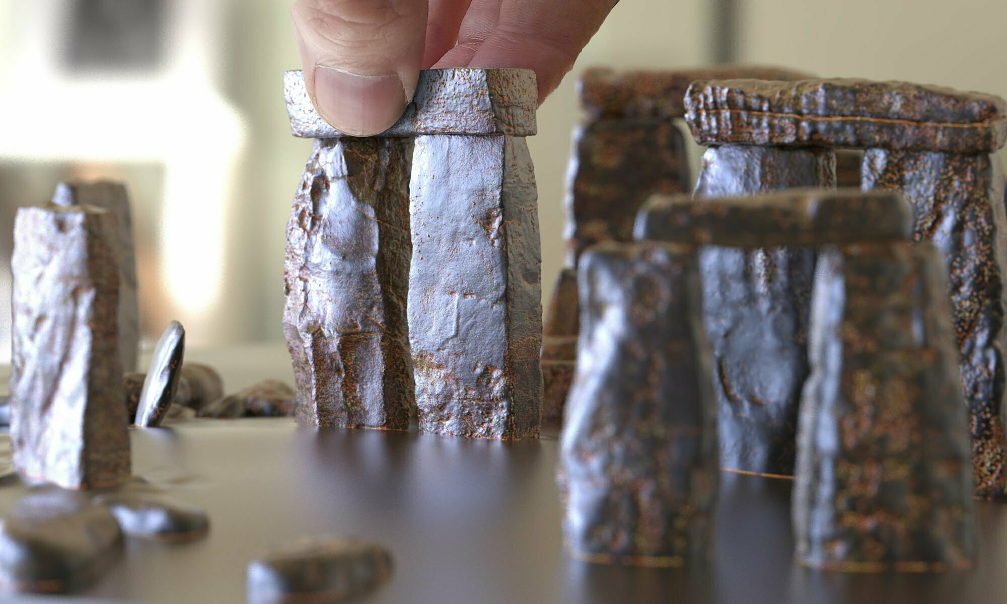
They complained. Traffic past Stonehenge was glacial, they said, all because drivers slow down for a gawp at the stones. Little did they know. Four hundred and fifty thousand years ago the whole queue might have been sitting under an ice sheet.
Might. Hold on to that word; it does all the work in this post.
So they decided to build a tunnel. Under a UNESCO World Heritage Site. You cannot just dig; you have to check the buried history first. So they dug, and drilled, and augered, and trenched. Seven hundred times.
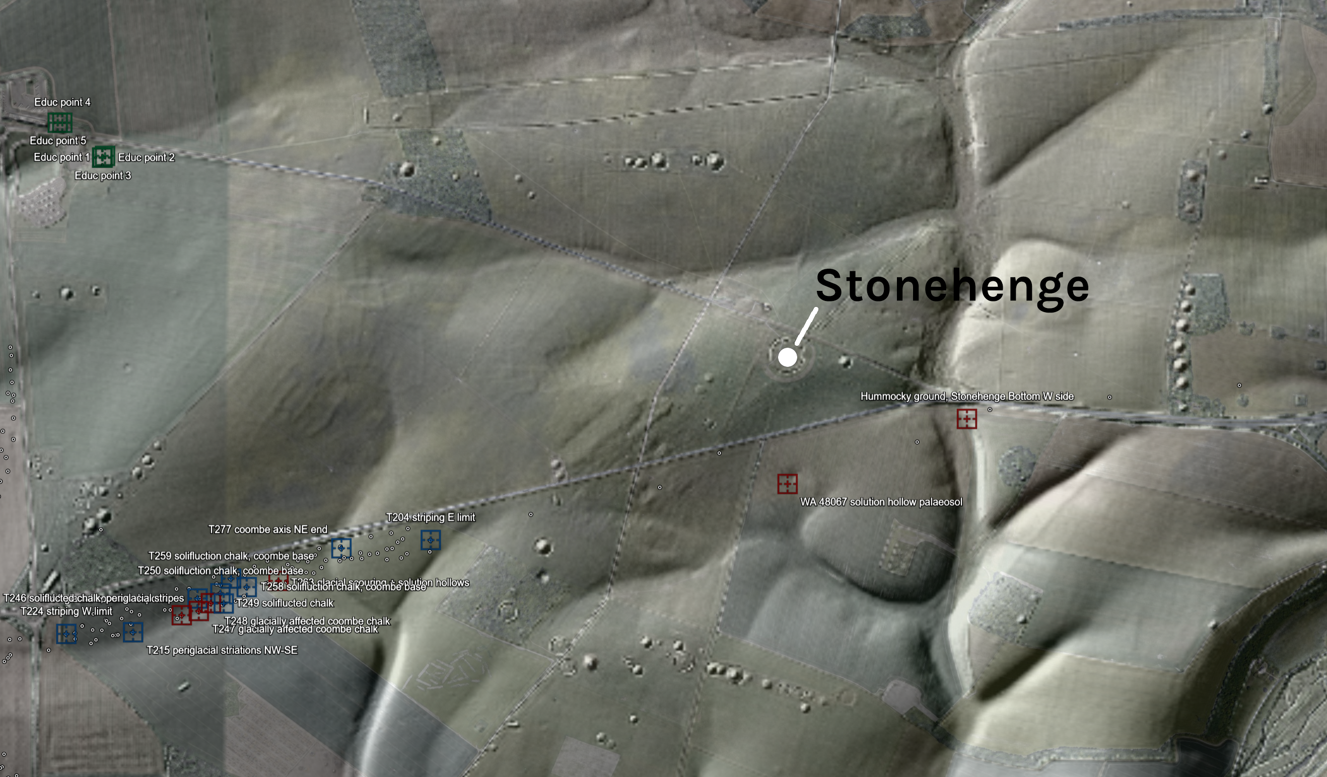
LIDAR: (c) Environment Agency copyright and/or database right 2026, Open Government Licence. Imagery (c) 2026 Google.
The picture above is the whole area under LiDAR, low sun from the north-west, every bump on Salisbury Plain standing to attention. The coloured squares are my gazetteer. Red for the primary records. Blue for trenches where the diggers wrote cold-climate words on their sheets. Grey for a line of auger holes, green for a 2023 evaluation by the visitor centre, purple for a borehole transect, orange for four drilled cores that went off to a laboratory and never came back. All of it lives in a Google Earth file you can spin round yourself. Turn the layers on and off. Fly about. It is the best free toy I have made all year.
I have read the lot. Forty-three public documents, 11,302 pages of borehole logs, trench sheets, laboratory appendices and method statements, put through a scanner with one question: ‘did anybody, anywhere along that road, record anything glacial?’ All from one road scheme, mind; Historic England’s own archive is another trawl for another day. What came back is not proof. Hints. But damn, some of them are suspicious.
Quick background. The Irish Sea Glacier came south out of western Scotland, down the gap between Ireland and Wales, wrapped round south Wales and pushed up the Bristol Channel onto the Somerset coast. That much has evidence behind it: tills, and buried glacial channels at Court Hill and Kenn, by Clevedon. Erratics recycled down the Avon valley gravels. Pembrokeshire rock lying about on Gower, collected, mapped and photographed by Peter Kokelaar, whose Stonehenge page is the best single account of the ice case I have read. A till-like deposit out on King’s Sedgemoor, maybe the eastern limit. Some of these are argued to be massively old, even pre-Cromerian Stage, around 800,000 years ago. Remember, one glaciation rubs away much of the previous. And erratics tend to be erratic, then erratic again, and again.
The fight is over how much further east the ice reached. Whether it ever crossed onto the chalk, and whether the bluestones at Stonehenge, the dolerites, rhyolites, tuffs, dacites and sandstones, rode along with it. I think they did. Most archaeologists think teams of Neolithic people with ropes did it instead. That argument is for another page, if I can be bothered. This page is about what the road men found.
Maybe even further east than Stonehenge itself
Let us be clear about scale first. There are 698 recorded holes and trenches: most of them tracking the A303 itself, a handful at the new visitor centre at Airman’s Corner, a handful below Rollestone Camp on the Packway. A thin ribbon of tested ground across a huge landscape. Out of all that, my gazetteer of hints runs to 44 entries. A tiny tested area, and a small crop of hints. Still…
One securely identified, properly dated glacial deposit would be enough. Nothing below reaches that bar yet. Whether anything could is the whole game.
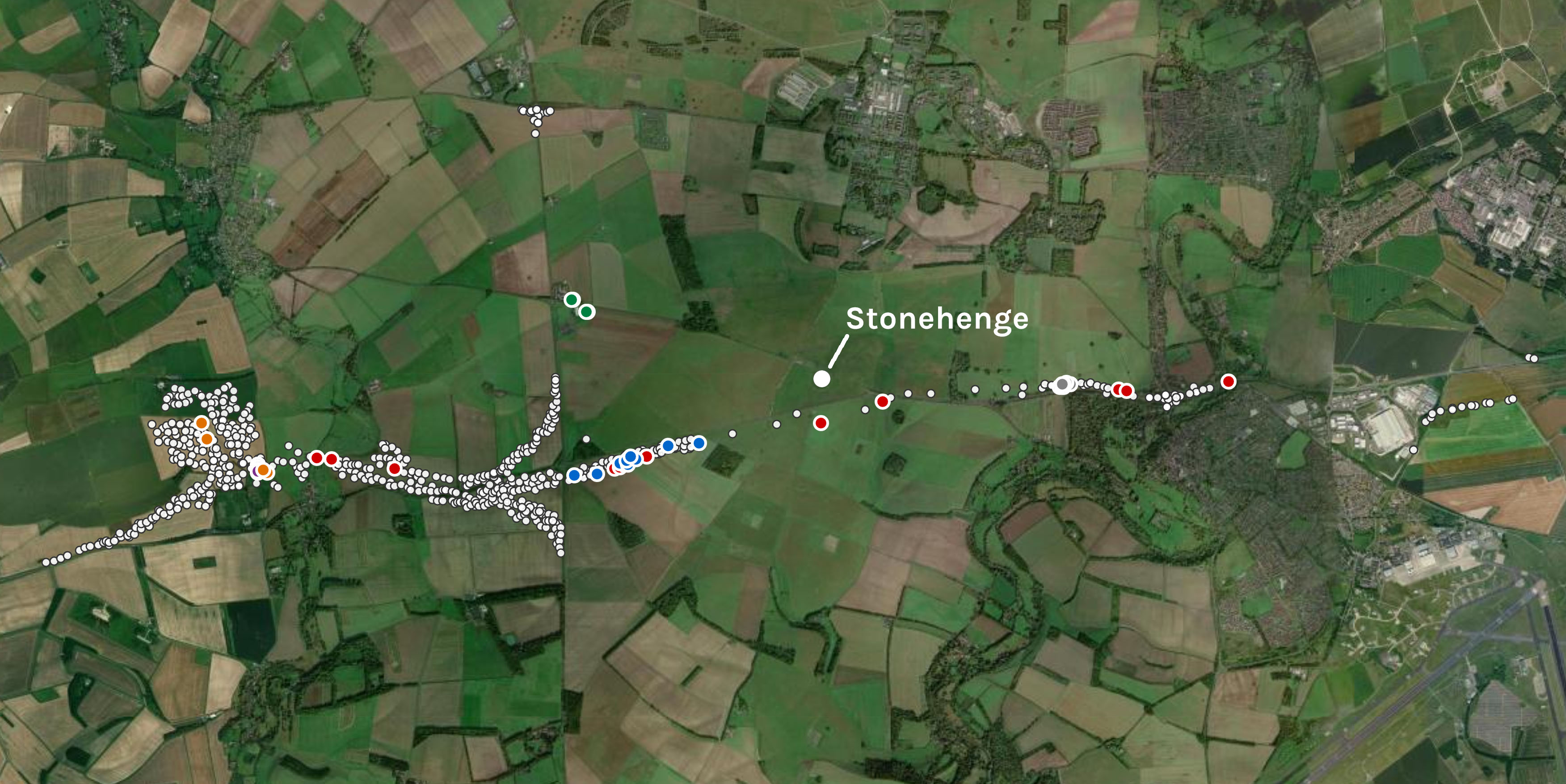
Imagery (c) Esri, Maxar, Earthstar Geographics.
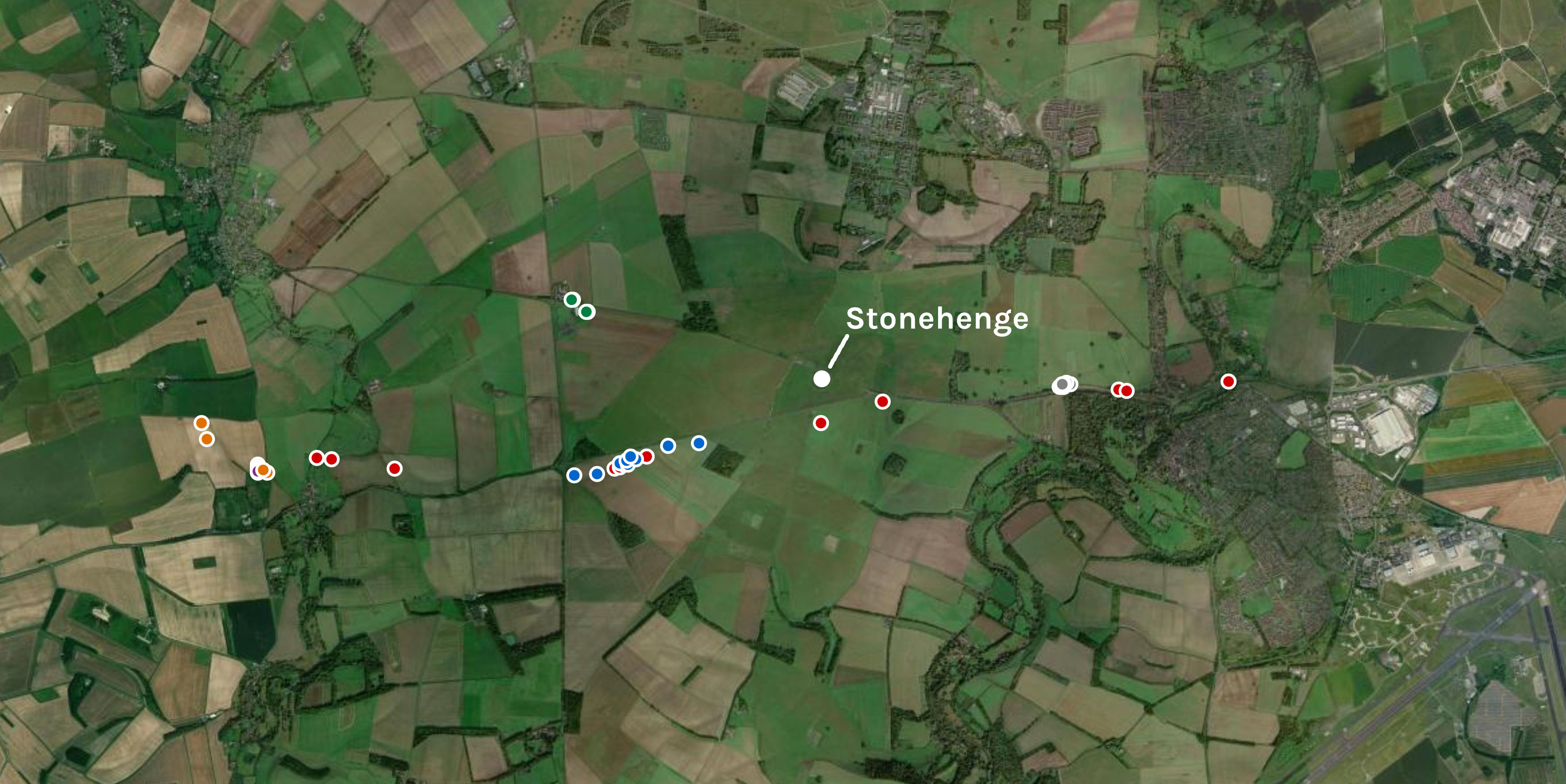
Imagery (c) Esri, Maxar, Earthstar Geographics.
Hints, in common parlance
Keep the locations out of your head for a minute. Here is what the words in those reports actually mean, in plain talk, for people who do not spend their evenings inside engineering PDFs.
The big excitement
Till. Till is what a glacier leaves behind: everything it ground up and dragged along, dumped in one unsorted mess. Clay, sand, gravel and boulders, all sizes together, no layering. Find true till and you have found ice. One context description in Trench 511 has a deposit laid down on glacial till. Nobody logged the till itself. Here the paperwork bites.
The till words belong to context 51132. Sample 51138 came from 51135, the “light green sand and degraded chalk” next door. Same natural sequence, 51103, different context. I read two rows of a table as one.
Forty litres of 51135 went into bags. Thirty-eight of them went through processing for charred seeds and charcoal. Whether any residue, flot or unopened bag is still on a Wessex shelf, the report does not say. So: worth asking, but not forty litres of till waiting in a store. Correction, 8 September 2026
Quartzite. Quartzite is hard, and it has no home on chalk. A quartzite clast on Salisbury Plain came from somewhere else: an ancient river, the vanished Palaeogene cover, the Clay-with-flints, or ice. Being nearly indestructible, quartzite is exactly what survives when everything softer has dissolved away. One log records it, in one pit, as “rare quartzite” in a gravel: no shape, no size, no count. That proves non-chalk input. It does not name the courier.
Hummocky ground. A chaotic patch of mounds and hollows. In glaciated country it forms when buried blocks of dead ice melt out and everything on top slumps. On chalk it is rare, so when it turns up beside Stonehenge with a neat bench along its toe, it earns a look. It might just be old quarrying. Of the three up here, this is the weakest, and the easiest to kill with one trench. It has never been archaeologically dug.
Unexpected items in the bagging area
None of these needs an ice sheet within a hundred miles. Cold, gravity and time will do; colluvium does not even need the cold.
Colluvium. Hillwash. Loose soil and stone that creeps and washes downslope and piles up at the bottom. Poorly sorted, weakly layered, and thickest wherever a slope meets a valley floor. It is still forming today; it needs nothing colder than rain, a slope and time. The frozen version comes next.
Coombe rock. During the ice ages the ground here was frozen solid. Each brief summer the top metre thawed into a waterlogged slush of frost-shattered chalk, and gravity walked it downhill. The process is called solifluction. Where the slush collected in valley bottoms and set hard, it became coombe rock. The valleys round Stonehenge are floored with it.
Solution hollows. Chalk dissolves in rainwater. Slightly acidic water finds a joint, works on it for a few thousand years, and leaves a pipe or a closed hollow in the surface. Anything lying about tends to end up in them.
Palaeosol. An old land surface. A fossil soil, buried and kept under younger sediment. Soils only form when a landscape is stable and warm, so a buried soil trapped inside cold-climate rubble marks a warm window between two rough patches.
Argillic brown earth. A soil where rain has washed fine clay from the topsoil down into the subsoil, grain by grain, over thousands of years. It takes a long quiet interval to make one, which is the point.
Flinty drift. Drift is the old catch-all for any loose deposit sitting on the bedrock, glacial or otherwise. A flinty drift on chalk is a spread of flint-dominated debris of uncertain parentage. The word ducks the question of how it got there, which is honest of it.
Periglacial stripes. Freeze and thaw, repeated for millennia, sorts soil into alternating bands running downslope. They show today as crop marks and soil stripes, fossil patterned ground from the permafrost years. The trench sheets are full of them.
The Allerod soil. Between roughly 14,700 and 12,900 years ago Britain warmed sharply, the Windermere Interstadial, before one last cold snap. Land surfaces briefly settled and soils formed. Find one of those buried under later frost rubble and you are holding a dated moment of calm from the end of the last ice age.
Barely surviving after 450,000 years
Now the where. Almost every entry in that gazetteer sits in a sink: a coombe floor, a valley bottom, a solution hollow, the toe of a slope. Nothing on the tops. Brian John has written recently about why: the surface of Salisbury Plain has come down by something like eight to ten metres since the Anglian ice age, dissolved and stripped grain by grain, so the land any ice would have touched is simply not there any more. Chalk is toxic to geological memory. It eats its own calcareous deposits and scatters the rest. What survives, survives in holes.
He has also revisited Newall’s Mound, the low hummock at the elbow of the Avenue, and turned it upside down: some solution hollows are so old, and the clean chalk around them dissolves so much faster, that the ancient hollow now stands proud as a mound, capped with a metre and a half of clay-with-flints. Topographic inversion, the same trick that turns a debris-filled hollow in wasting ice into a kame. Yesterday’s sink, today’s summit, still holding its residue.
Two honest cautions before anyone gets excited. First, an ice-free chalk landscape does exactly all this too: periglacial freeze and thaw strips the shoulders and fills the bottoms whether or not a glacier ever called by. The pattern tells you where the archive is, not what is in it. Second, selection bias. The road men dug where the road goes, and the road, like every sensible road, follows the low ground. Trenches in coombes find coombe deposits. Fair cautions, both. But neither one empties the holes. Whatever is down there is still down there. Nobody has looked.
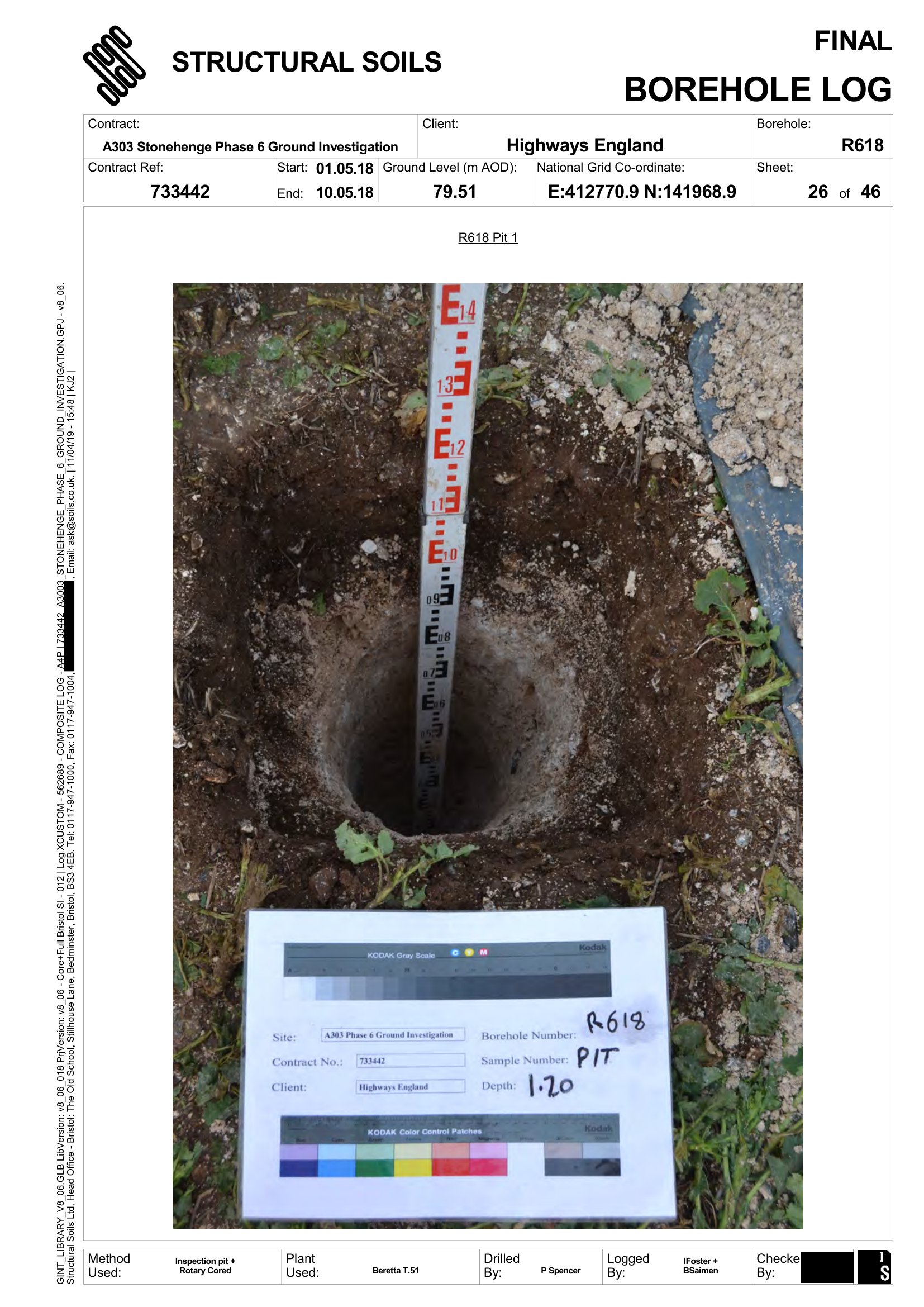
Photograph: Structural Soils Ltd for Highways England. TR010025-002245, PDF p916
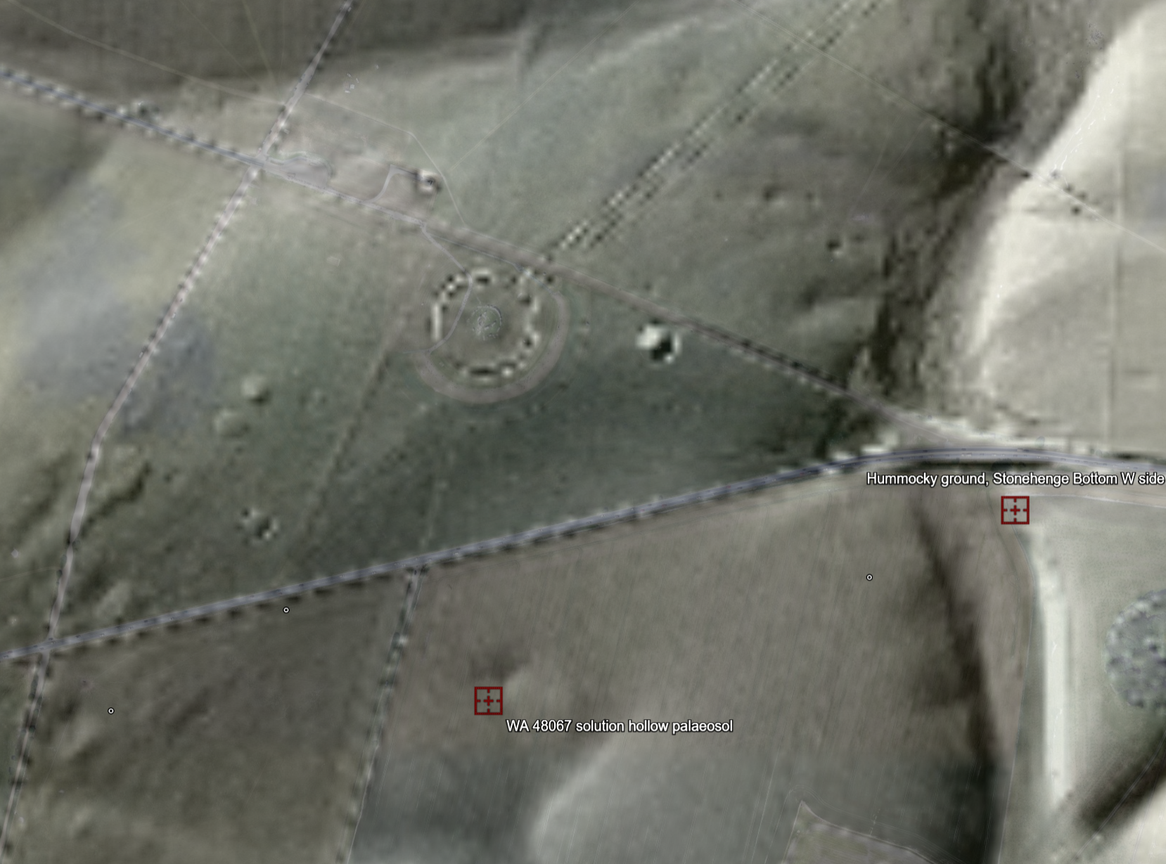
LIDAR: (c) Environment Agency copyright and/or database right 2026, OGL. Imagery (c) 2026 Google.
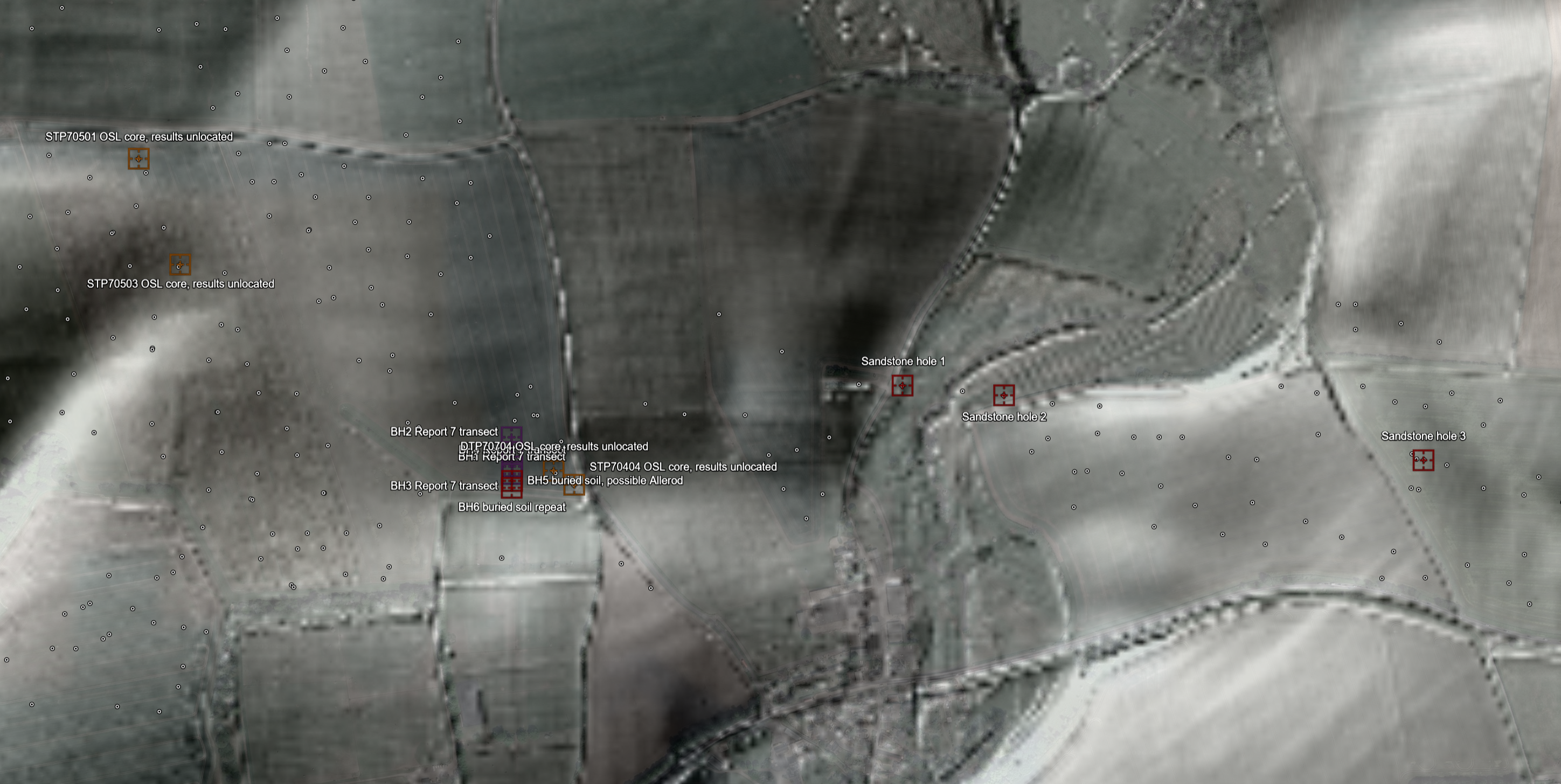
LIDAR: (c) Environment Agency copyright and/or database right 2026, OGL. Imagery (c) 2026 Google.
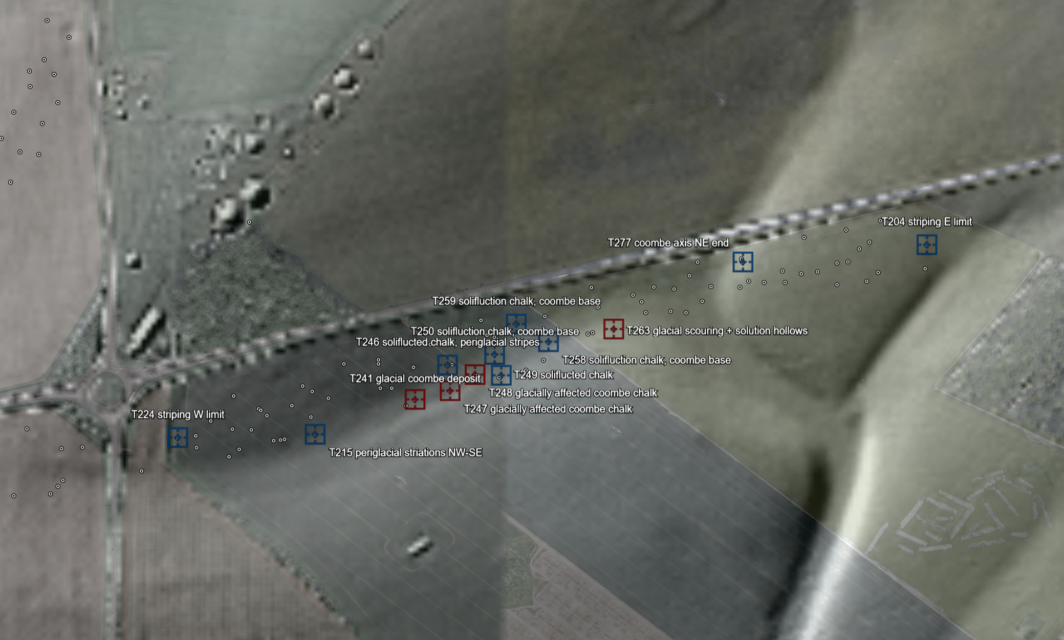
LIDAR: (c) Environment Agency copyright and/or database right 2026, OGL. Imagery (c) 2026 Google.
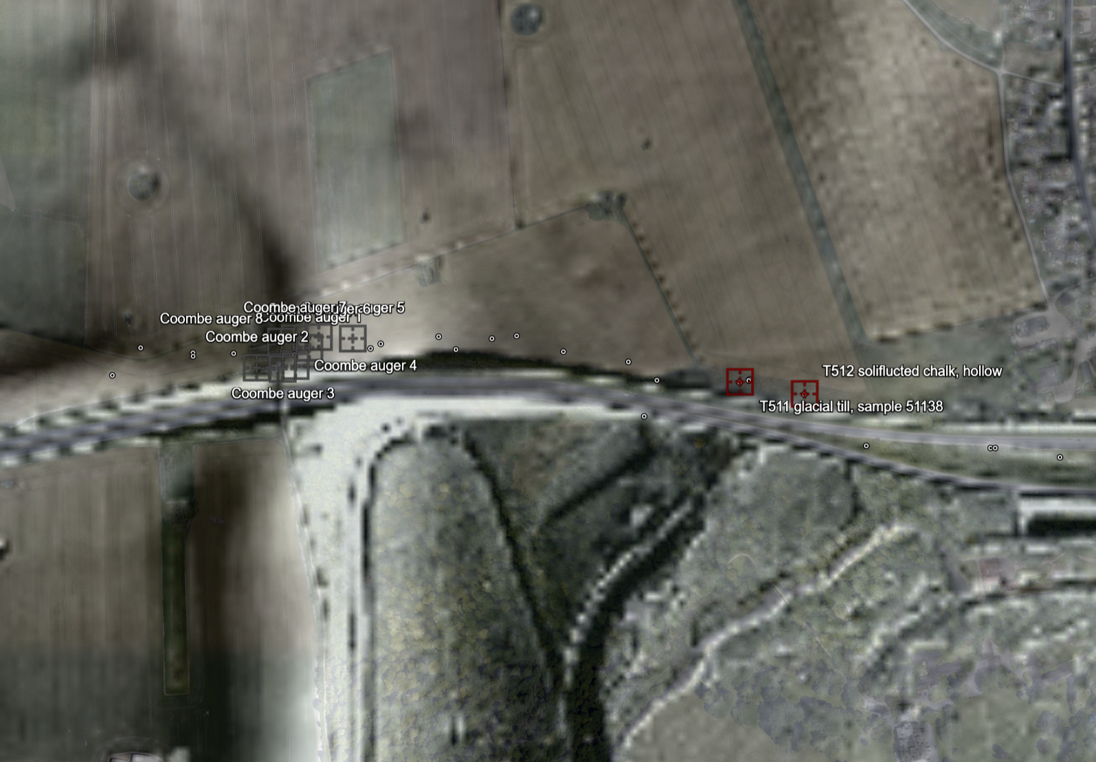
LIDAR: (c) Environment Agency copyright and/or database right 2026, OGL. Imagery (c) 2026 Google.
And the evidence is…
This section is for the people who need document numbers, page numbers and grid references: the scientists, the sceptics and the happily anally retentive. Every image below is a page from a public document; click through for the full-size scan. The bracketed (colours) match the gazetteer, and the full documents are linked at the foot.
Primary records (red). Located, page-referenced records of durable non-chalk material in natural deposits, or of deposits recorded with outright glacial wording.
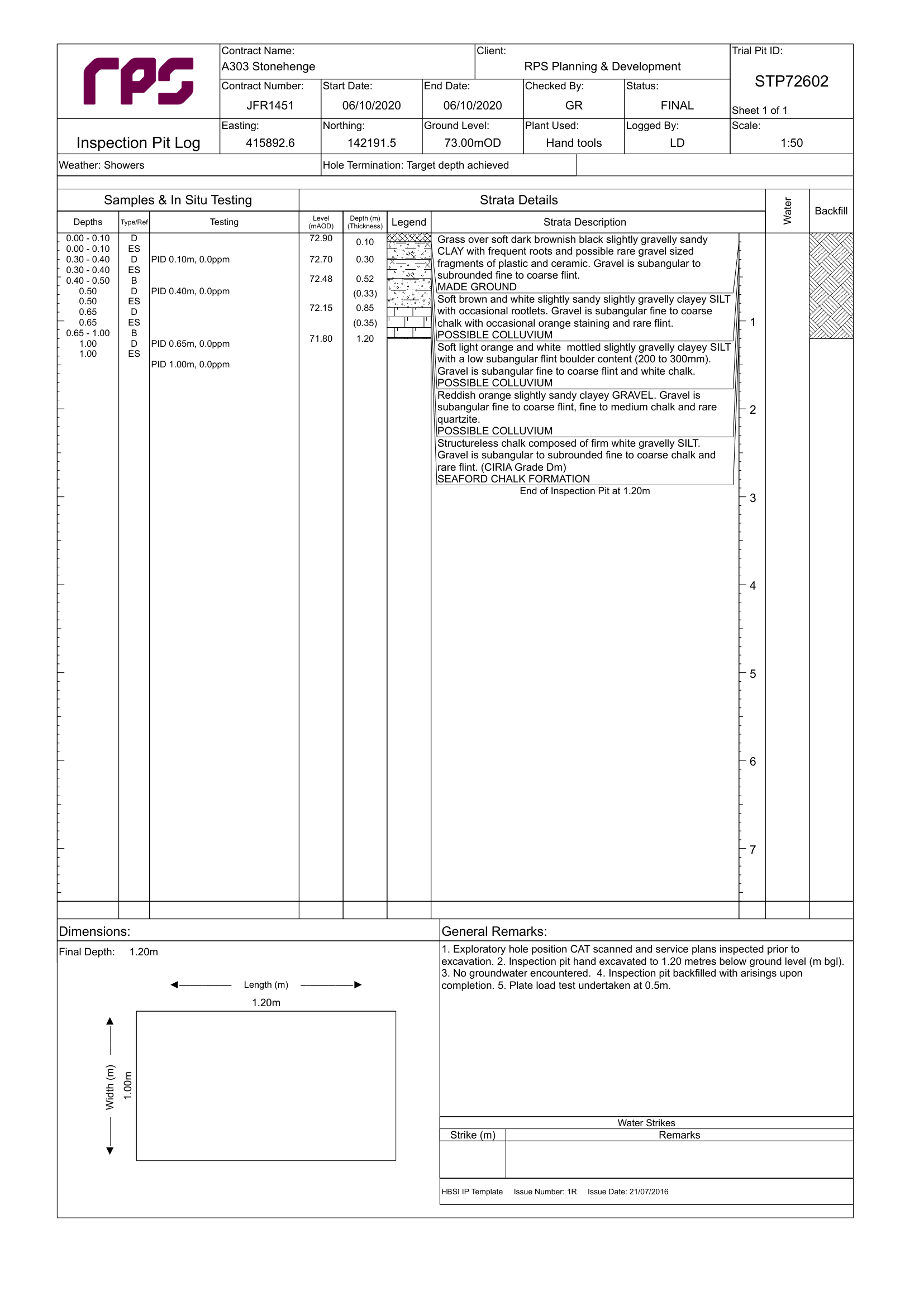
Phase 7B Factual Report, TR010025-002259, PDF p236
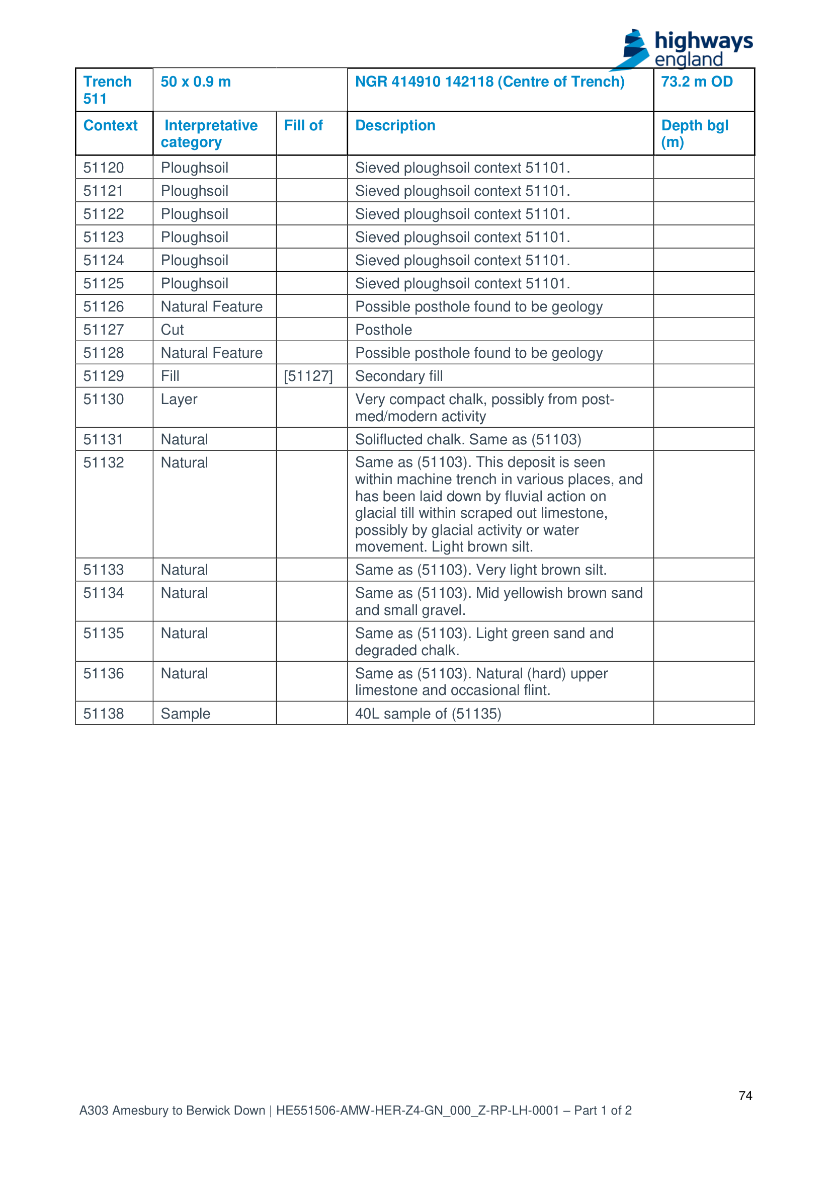
Report 5, TR010025-000584, PDF pp. 74–75 and 85.
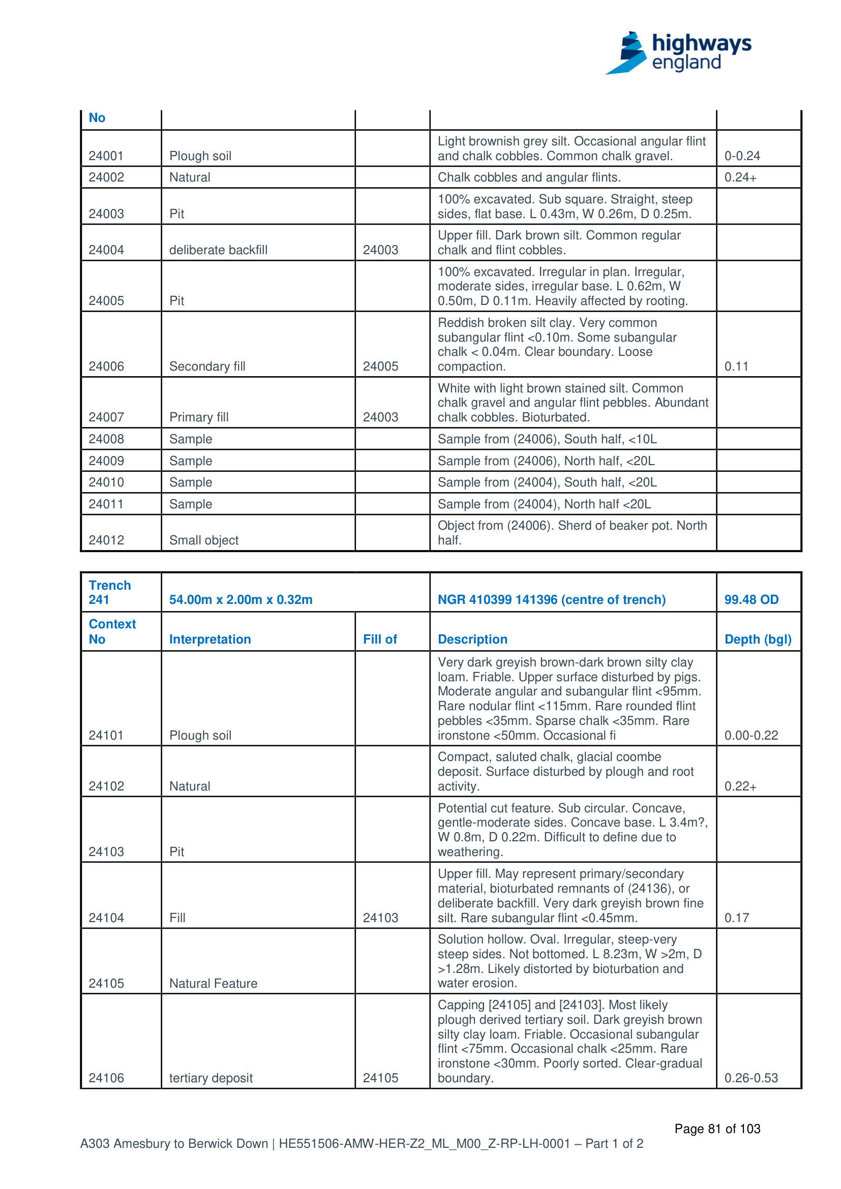
Report 4, TR010025-000582, PDF p81
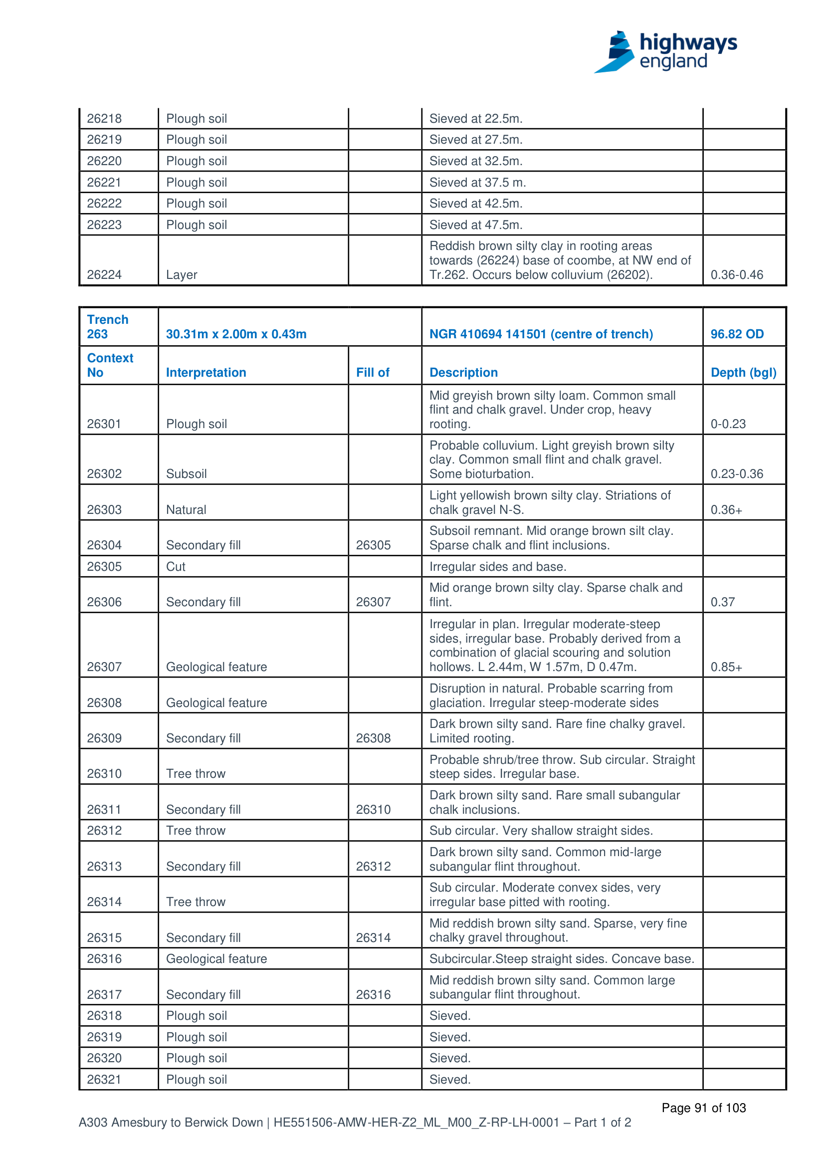
Report 4, TR010025-000582, PDF p91
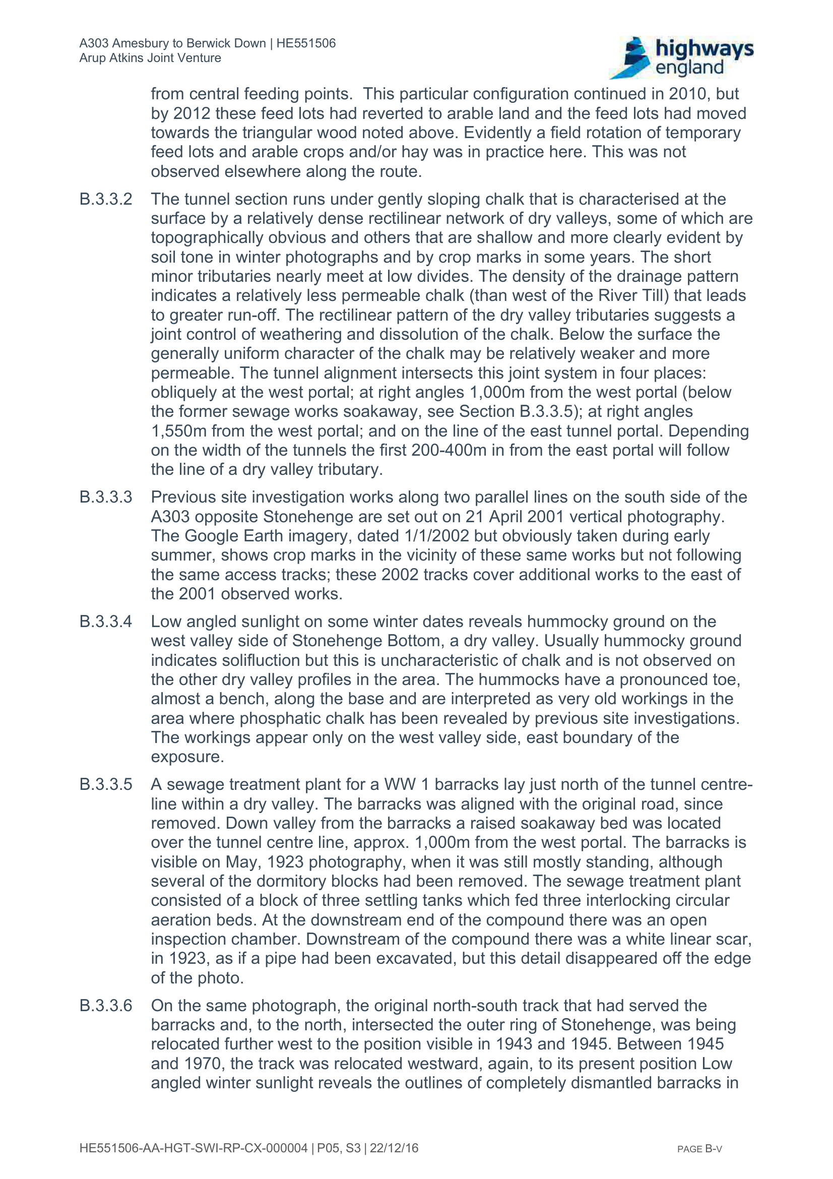
PSSR, TR010025-000429, PDF p145
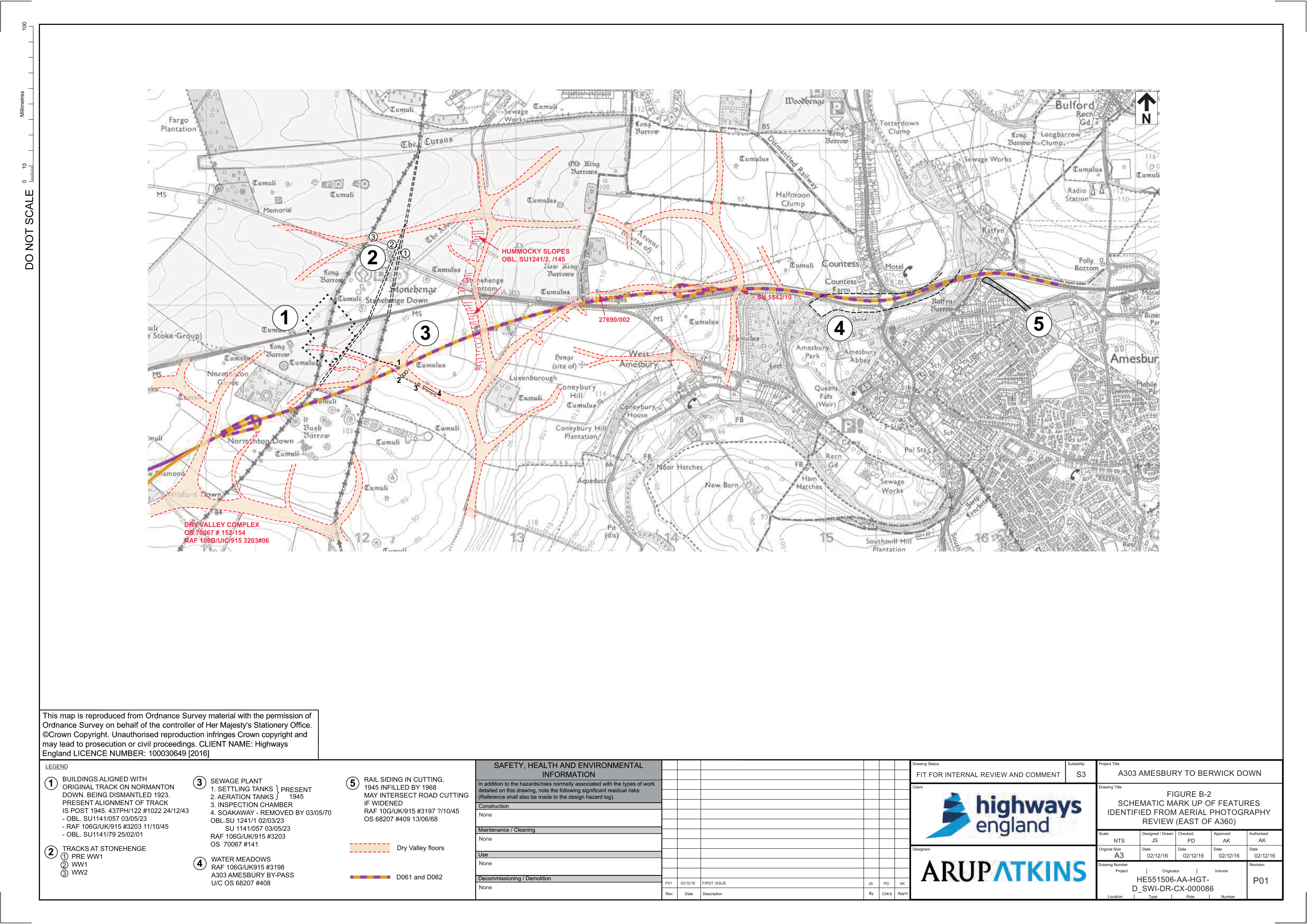
PSSR, TR010025-000429, PDF p153
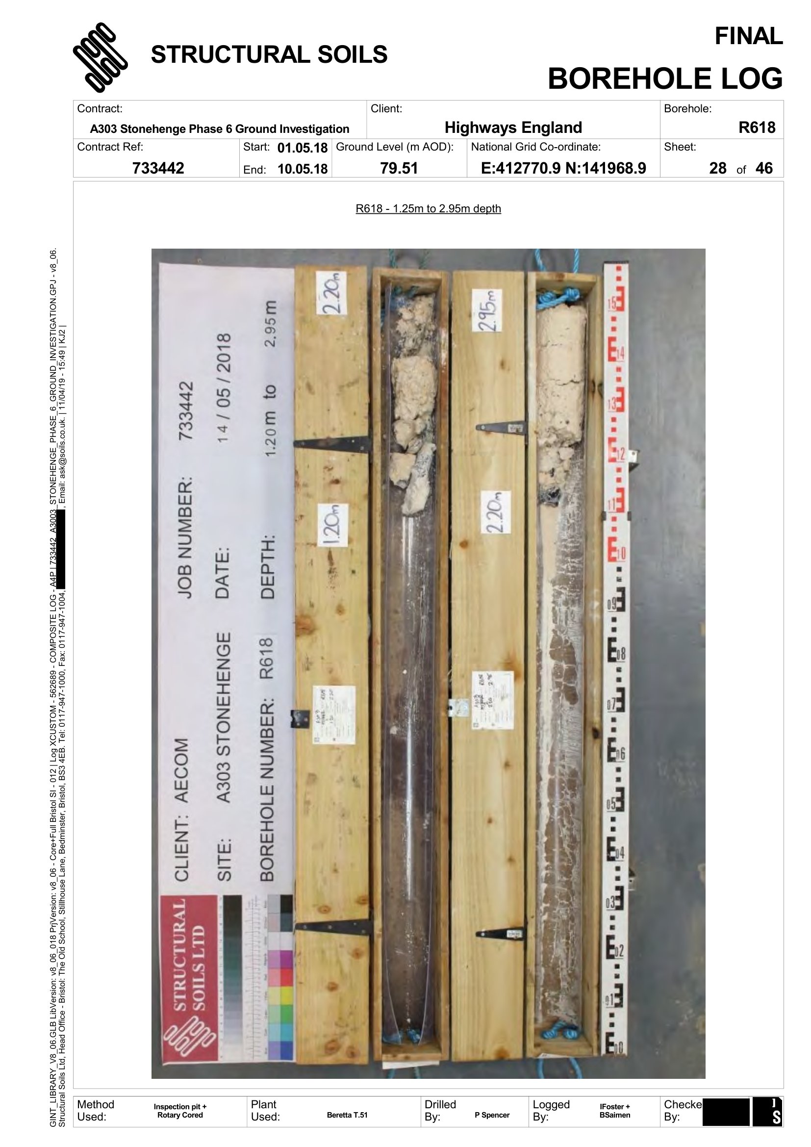
Photograph: Structural Soils Ltd for Highways England. TR010025-002245, PDF p918
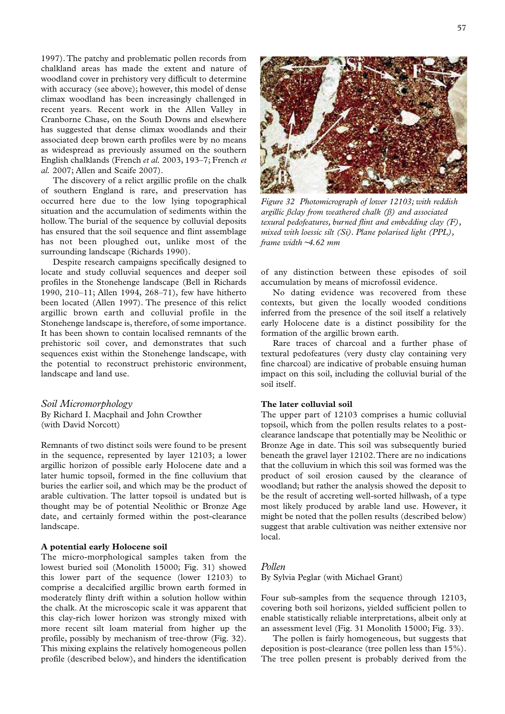
Leivers and Moore 2008, p67
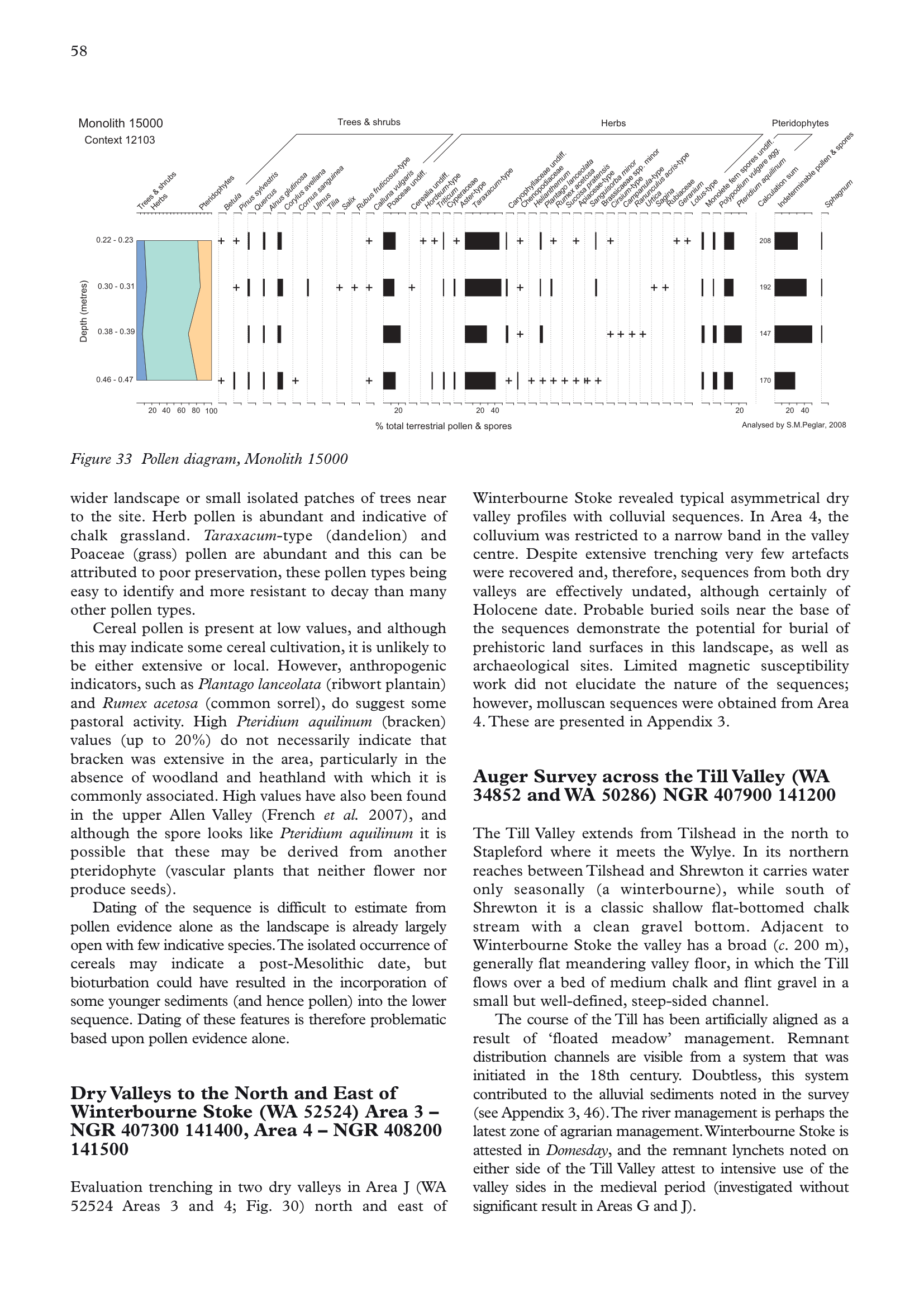
Leivers and Moore 2008, p68
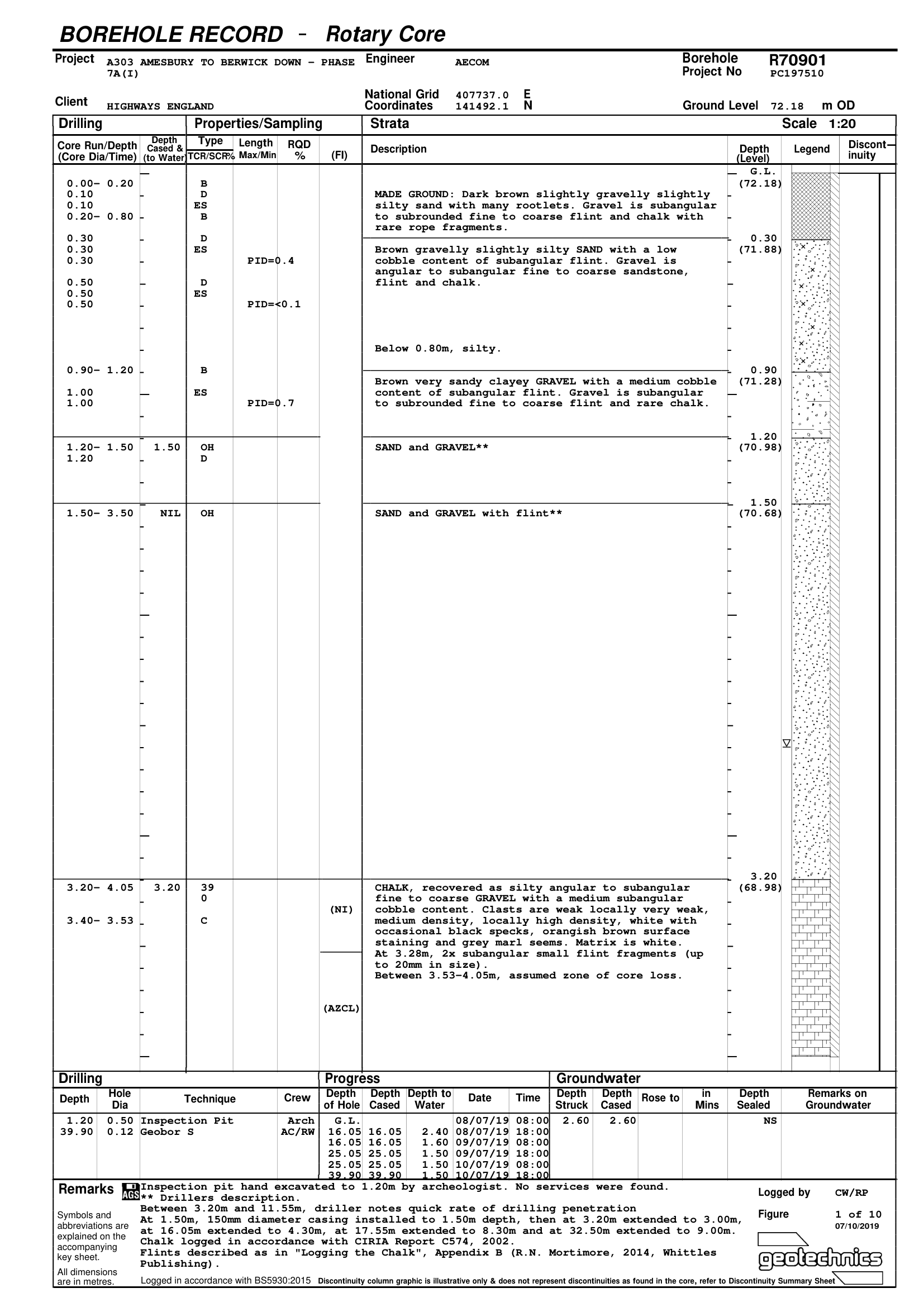
TR010025-002269, PDF p157
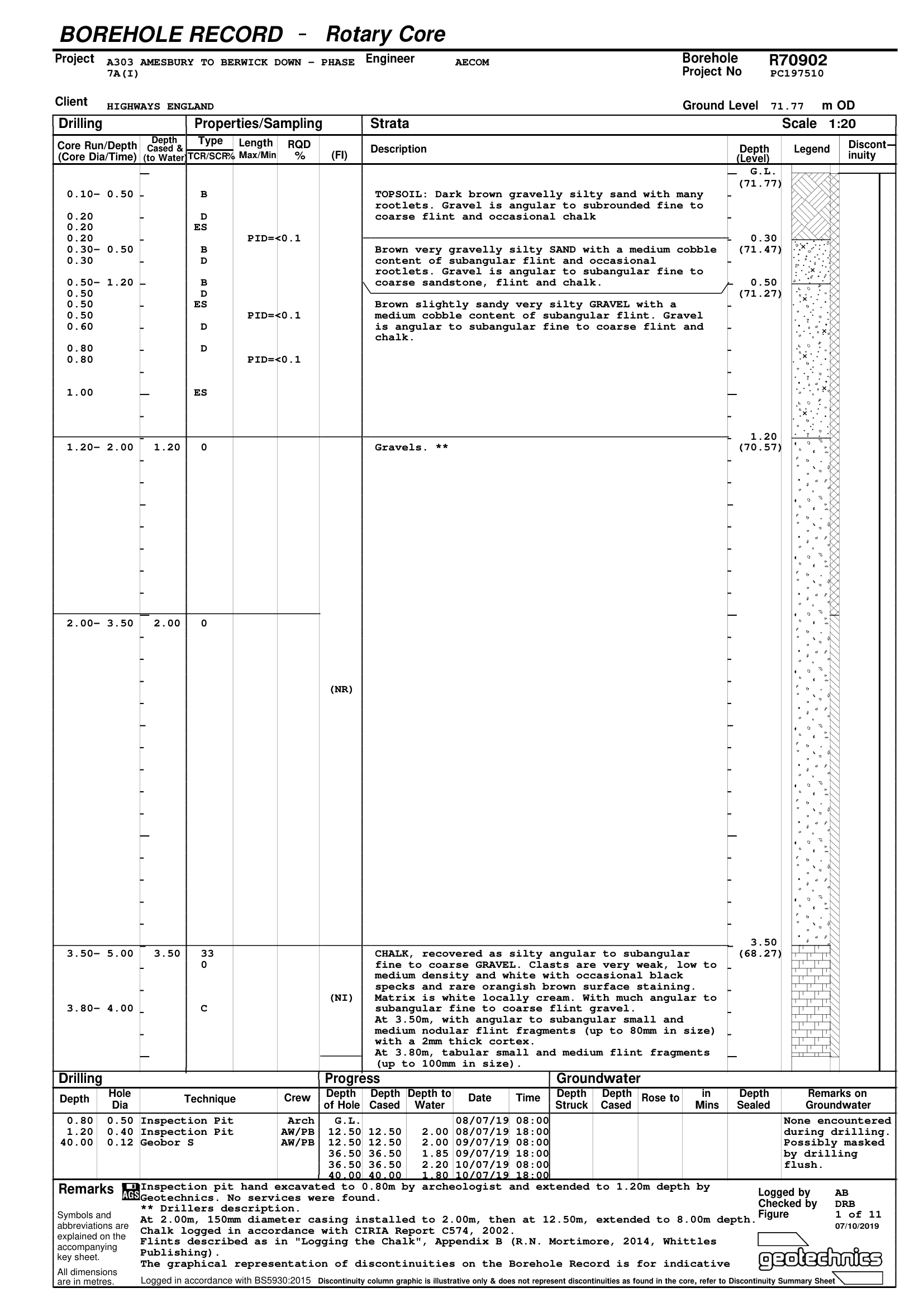
TR010025-002269, PDF p167
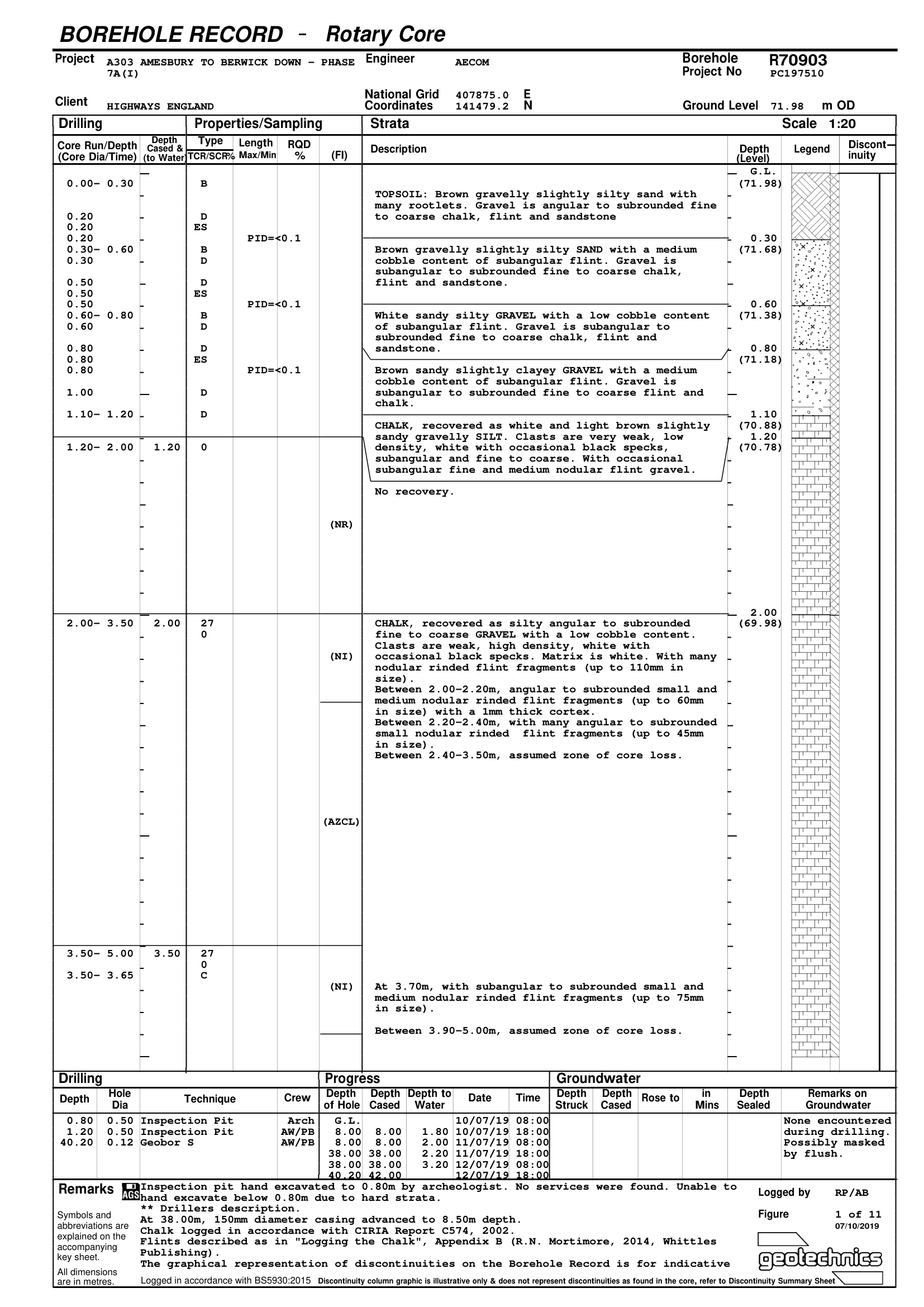
TR010025-002269, PDF p178
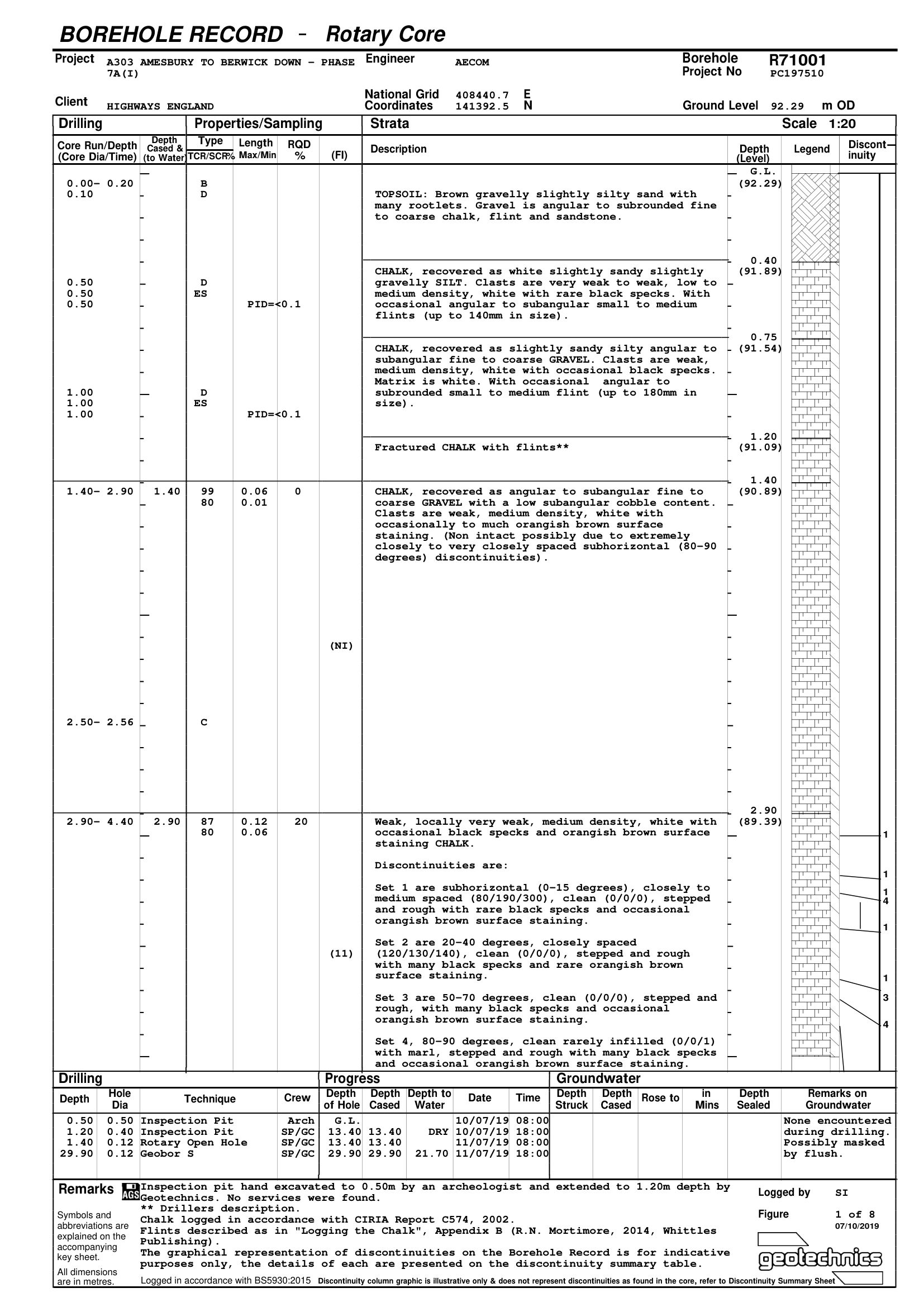
TR010025-002269, PDF p189
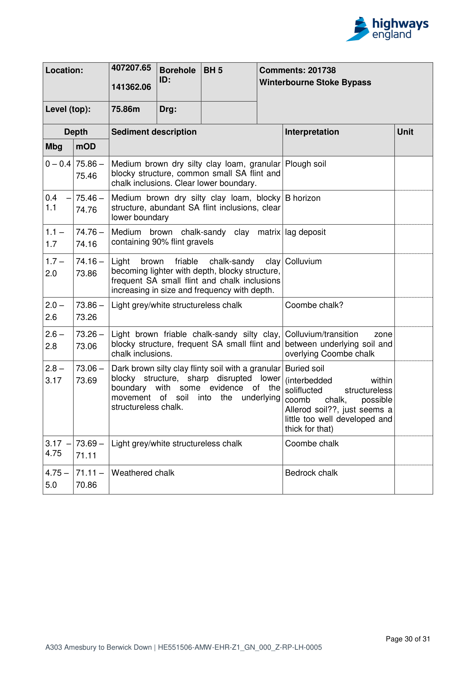
Report 7, TR010025-000588, PDF p34
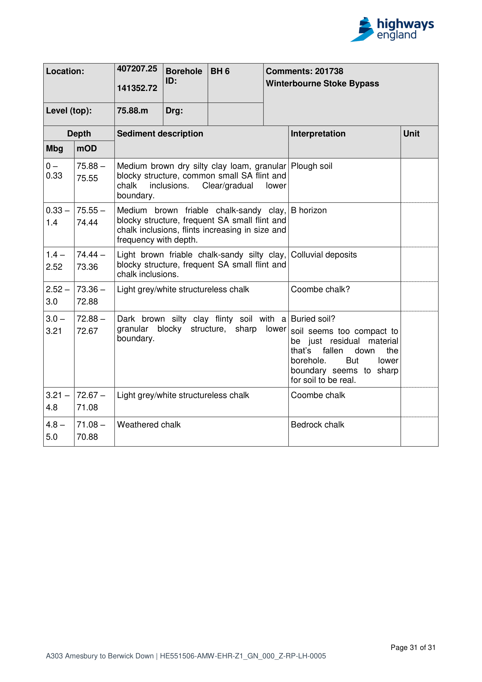
Report 7, TR010025-000588, PDF p35
Periglacial and cold-climate records (blue). Nine more trenches on the western approach whose context sheets record soliflucted chalk, periglacial stripes and striations: T215 (“periglacial striations orientated NW-SE”), T246 (“soliflucted chalk with periglacial stripes”), T249, T250, T258 and T259 (“solifluction chalk in base of shallow coombe”), with the striping running from T224 in the west to T204 in the east and the coombe axis heading north-east through T277. All in Report 4, TR010025-000582. Frost country vocabulary, note, not ice: these records set the cold scene and say nothing about a glacier.
Coombe augers (grey). Eight auger holes in the coombe north-west of Vespasian’s Camp, recording the same sequence in all but the two end holes: colluvium over coombe deposits over putty chalk over hard chalk. Report 5, TR010025-000584.
Education Projects 2023 (green). The most recent record of the lot, from an evaluation north of Airman’s Corner for an education building near the new visitor centre.
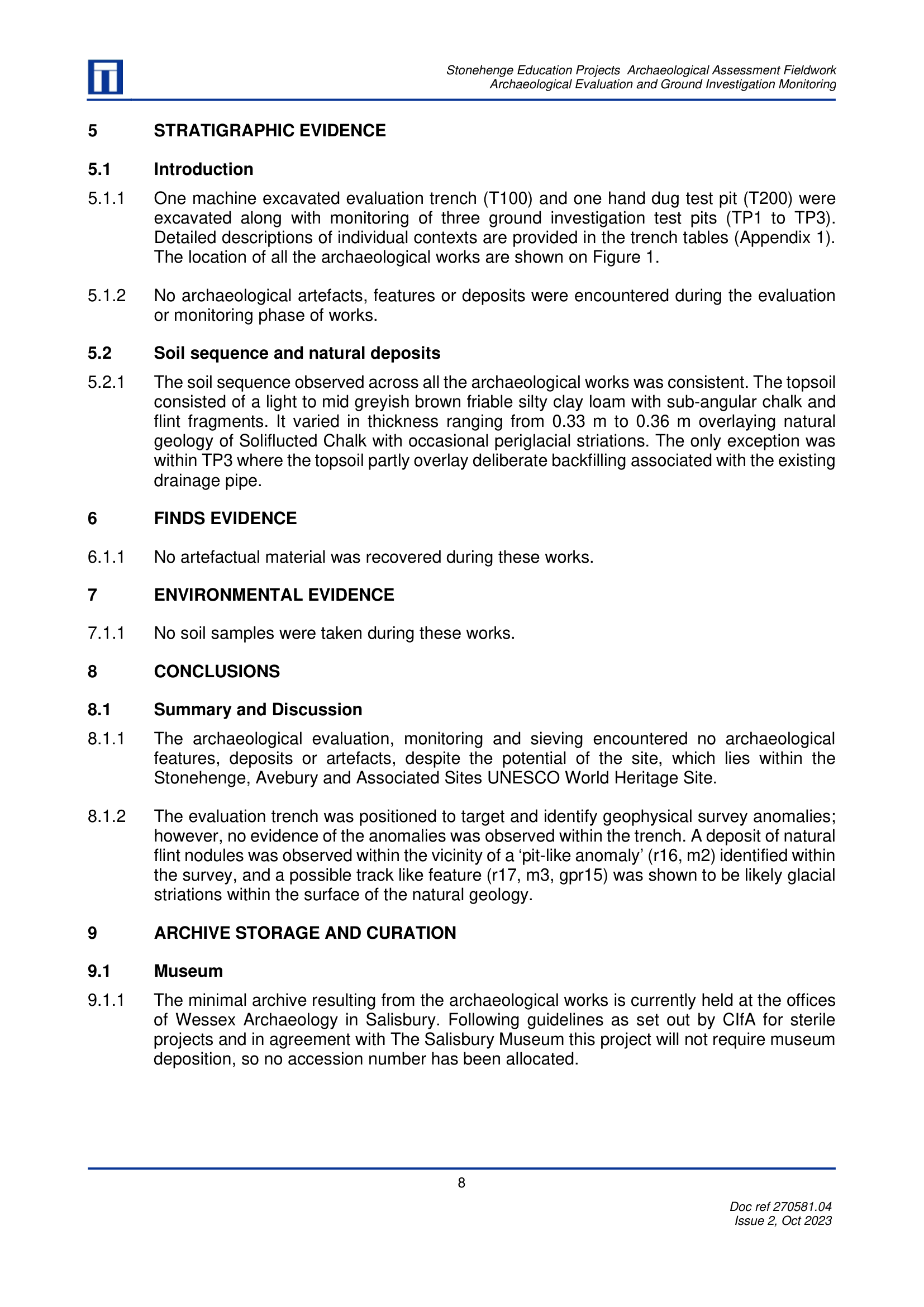
WA 270581.04, 2023, PDF p14
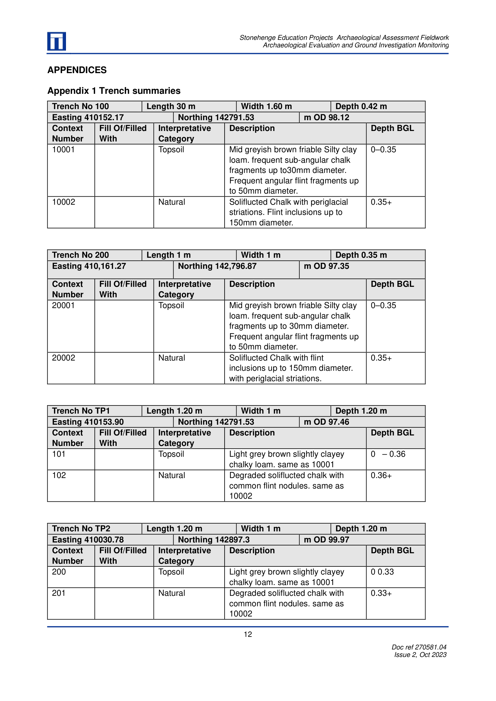
WA 270581.04, PDF p18
Report 7 transect (purple). Six boreholes on a 68 m north-south line down a coombe flank west of Winterbourne Stoke, drilled along an electrical resistance profile. The two southernmost, BH5 and BH6, hold the buried soil shown in red above.
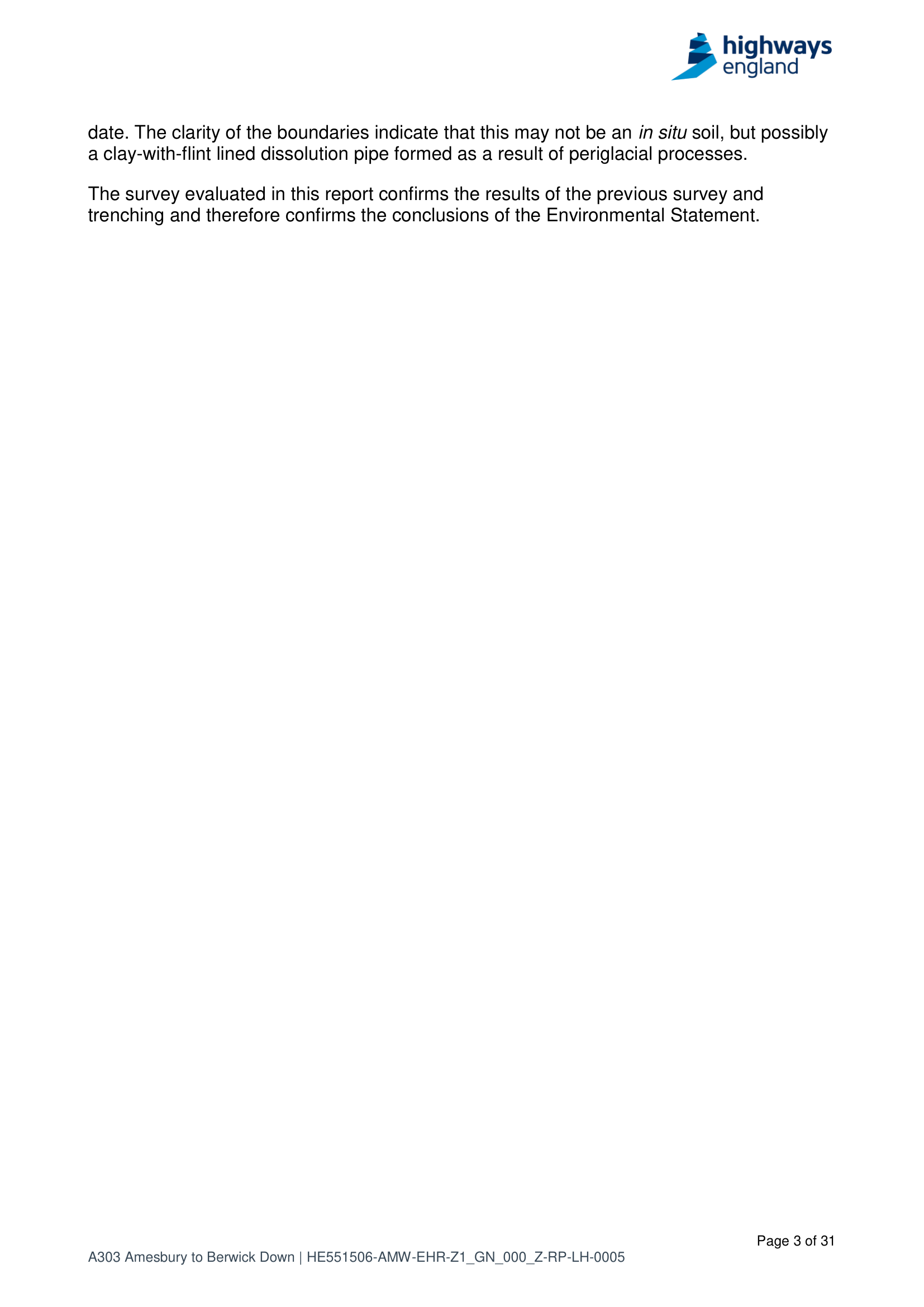
Report 7, TR010025-000588, PDF p4
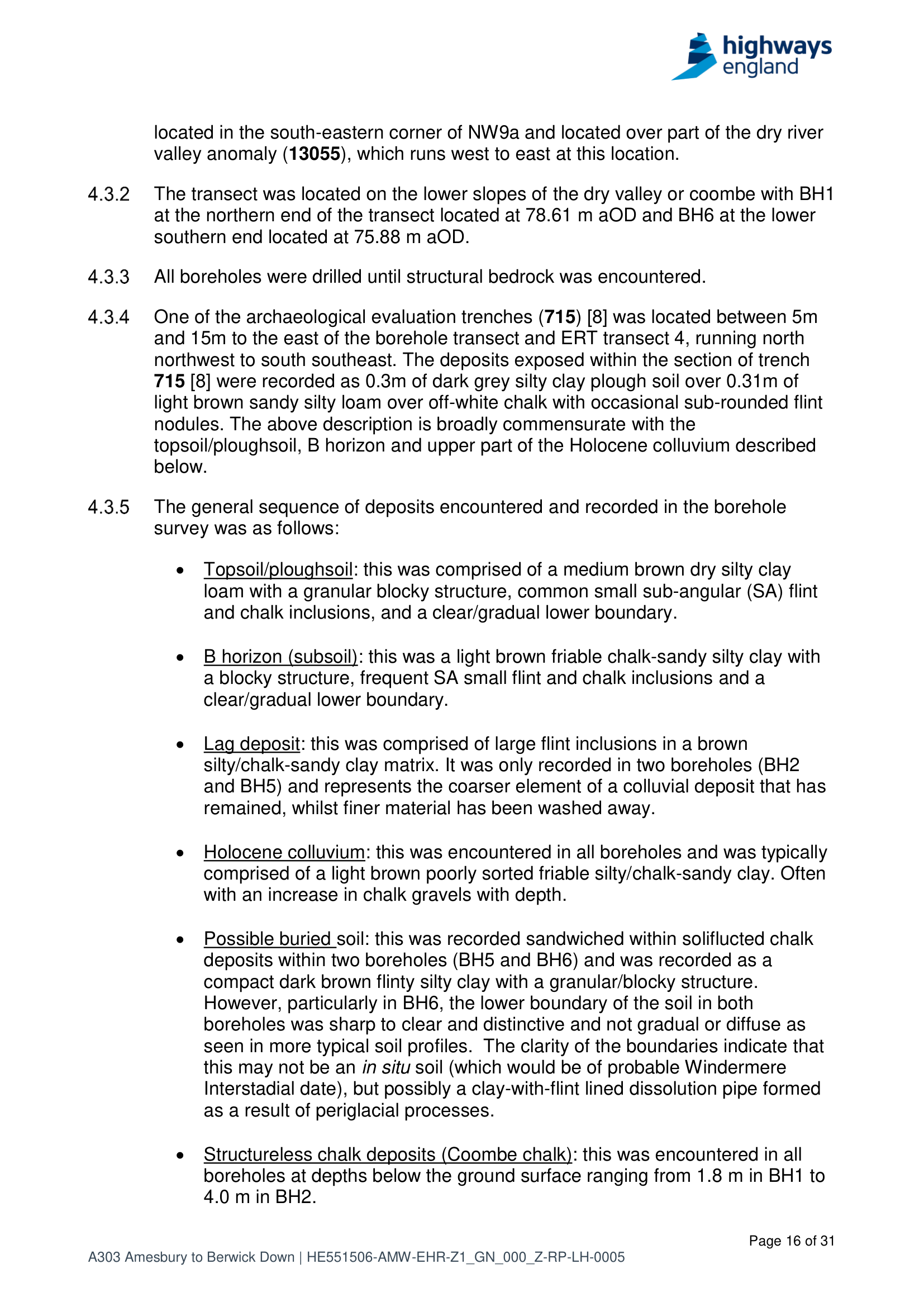
Report 7, TR010025-000588, PDF p17
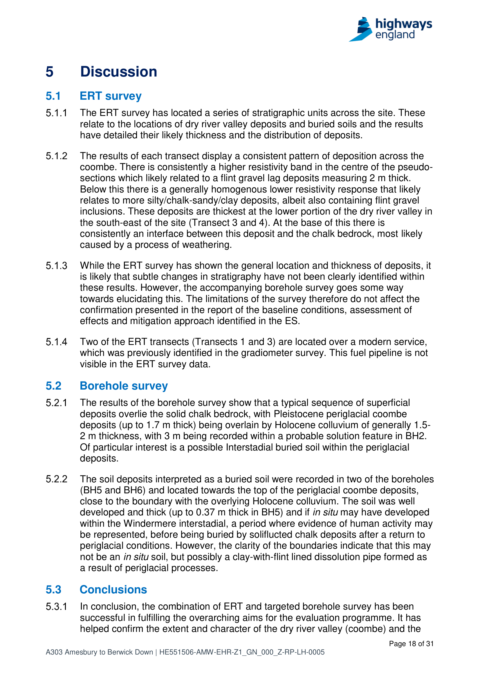
TR010025-000588, PDF p19
Phase 7B OSL cores (orange). Four rotary boreholes, STP70501, STP70503, STP70404 and DTP70704, drilled specifically for luminescence dating, cores sealed in black liners and sent unopened to a specialist laboratory (schedule with grid references at TR010025-002259, PDF p12). Two of them sit within ninety metres of the BH5 buried soil. The liners stayed sealed and the cores were never even photographed, because light destroys the luminescence signal. No results for these cores appear anywhere in the 11,302 pages. The scheme was cancelled in July 2023. Somewhere there is a laboratory report, or four cores still in their liners, or nothing at all: unsuitable, consumed, thrown away. One email would settle which.
The documents, all free:
- Preliminary Sources Study Report, ES Appendix 10.4 (TR010025-000429)
- Report 4, Western Portal and Approach, Part 1 (TR010025-000582)
- Report 5, Eastern Portal, Part 1 (TR010025-000584)
- Report 7, ERT and Borehole Survey (TR010025-000588)
- Phase 6 GI Factual Report volume 2-12B, with the R-series pit and core photographs (TR010025-002245)
- Phase 7B Factual Report (TR010025-002259)
- Phase 7a(i) Factual Report (TR010025-002269)
- Stonehenge Education Projects evaluation, 2023 (WA 270581.04)
- Leivers and Moore 2008, Archaeology on the A303 Stonehenge Improvement
What was not found
Now the part a believer would rather skip. In 698 recorded holes and trenches there is not one identified dolerite, rhyolite, dacite or tuff. No Preseli anything. The sandstone in the Till valley is most simply read as broken-up sarsen. The quartzite stands alone. And the standard BGS account of the Salisbury district tells its surface story with river terraces, head and hillwash, under climates running from subtropical to periglacial, and no glacier anywhere in it.
Say it plainly: this corpus counts against a rich field of bluestone erratics lying about near Stonehenge. A sparse, half-dissolved Anglian scatter surviving only in hollows could still slip through a corridor of narrow holes, but that is an argument about preservation and sampling, not a find. The case this page makes is smaller and harder: a handful of deposits exist through which the question might be tested, together with one bagged sample from the Trench 511 natural sequence, if any of it still survives.
The strongest case against
Fairness demands the other side’s best shot, and it is fresh. In January 2026 Clarke and Kirkland published a study built to test exactly this question: detrital zircon and apatite fingerprinting of stream sediments draining Salisbury Plain. They analysed 550 zircon grains and 250 apatites from four river-sand samples, the Avon twice, the Wylye and Pillhill Brook, hunting the distinctive 464-million-year Preseli signature. One grain matched. They read the rest as recycled local sediment, shed from the long-vanished Palaeogene cover, and concluded that the Plain was never glaciated and the stones did not arrive by ice.
Questions worth asking back, and they are questions, not rebuttals. Can four modern stream samples see a sparse Middle Pleistocene deposit trapped in solution hollows and dry coombe floors that feed no stream? Does a missing Preseli fingerprint rule out ice, or only ice carrying much Preseli rock? Does the test tell no glacier from a glacier whose surviving sediment is vanishingly thin? Their own paper allows that the Anglian ice limit in central southern England is poorly constrained. And for what it is worth, their single Preseli-compatible grain came from the Wylye, the river that drains the Till valley sites above.
Here is the thing, though: their negative and my near-negative point the same way. If anything glacial survives on this Plain it is sparse, buried and hiding in holes, exactly where streams and field-walkers do not look. Which is why finding out what, if anything, survives from sample 51138, and sampling the right contexts properly next time, would beat any amount of argument.
A note on the authors, 11 September 2026
The sediment paper above is not a one-off. The same group at Curtin University, Anthony Clarke and Chris Kirkland among the authors each time, gave us the 2024 Altar Stone paper, which took a sound Laurentian zircon match and narrowed it to Orkney, then Caithness, on samples that were posted in rather than collected in the field. In September 2026 the same group gave us the Devil’s Arrows paper, which took a Kinderscoutian Millstone Grit match and narrowed it to one tourist crag at Brimham Rocks, sampled at one spot, then inferred an 18 km haul from it.
Same shape each time. A geochemical match that only reaches formation level, dressed up as a pinpoint. Ice ruled out by expectation rather than by anything dug up. And the human-transport conclusion sitting in the framing before the data arrives. I am not a geologist. Brian John and Peter Kokelaar are, and they have said it in their own words.
So read the questions above with that in mind. They stay questions. But three papers with the same tell is a pattern, and I would want every number in the next one checked before giving it the benefit of the doubt.
Who wrote these PDFs?
None of this is my fieldwork; I am, but a poor and simple artist & witch photographer, and none of the people who wrote the PDFs were looking for glaciers.
The Preliminary Sources Study came from the Arup Atkins engineering team, whose air-photo specialists combed old RAF and Ordnance Survey photography in the early 2000s and noticed hummocky ground under low winter sun.
The evaluation trenches, the auger transect and the borehole survey are by Wessex Archaeology, working 2018 to 2019 as archaeological contractor to the AECOM Mace WSP joint venture for Highways England, testing the ground ahead of the tunnel.
The factual ground investigation volumes are Structural Soils, RPS and their drilling crews, 2018 to 2021, logging strata for engineers who needed bearing capacities, not Quaternary history.
The luminescence work is the University of Gloucestershire’s dating laboratory.
The 2023 evaluation is Wessex again, this time for an education building by the visitor centre.
And the 2008 monograph is Wessex once more, from the earlier road improvement that never happened either.
Field sheets get written on a board in the rain – so I’m told. “Saluted chalk” is a typist’s rendering of soliflucted. “Possible Allerod soil??”, double question marks, is a person on a drilling rig arguing with themselves in a comments column. That is what makes these records worth something. Nobody was trying to find what I am looking for. The glacial vocabulary leaked out anyway.
Further analysis required 😛
Here is the uncomfortable part: almost none of this has been tested. The only luminescence dates in the whole corpus of PDFs are three caveated ages from a young hillwash stack in Trench 504, a Romano-British buried soil under a metre of medieval and later colluvium. Useful in its own way, because it measures how fast this landscape buries things: about a metre in two thousand years. But it never touched the deposits in question.
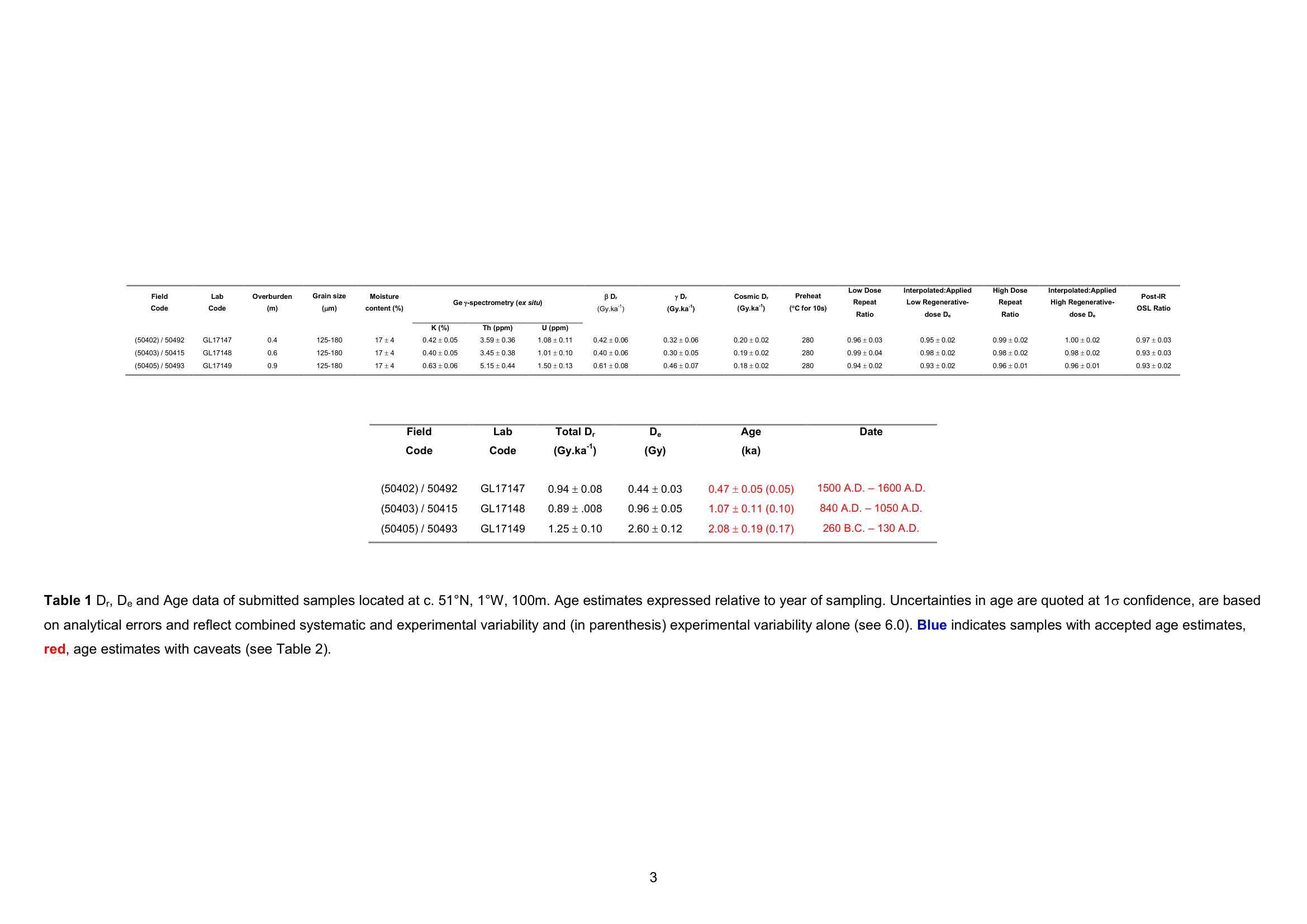
Report 5, Appendix D, PDF p90
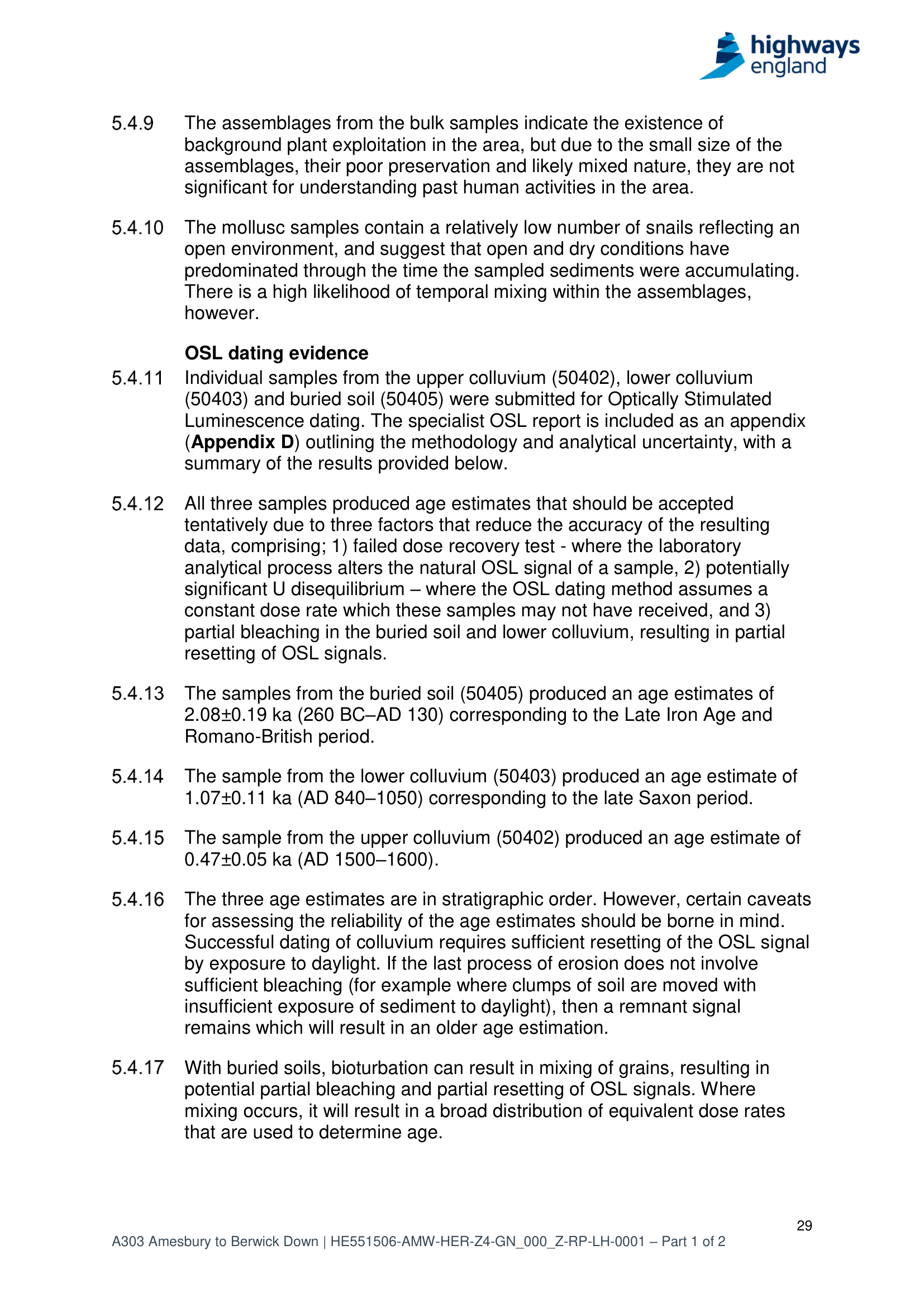
Report 5, TR010025-000584, PDF p30
- Sample 51138. Forty litres of light green sand from context 51135, not from 51132, the one with the till wording. Thirty-eight litres processed. Ask Wessex Archaeology what is left: residue, flot, an unopened bag. If anything, lithology and mineral provenance could still be run on it. It is not forty litres of till in a store.
- The four Phase 7B OSL cores: where are the results? If ages exist, publish them. If the cores were never run, they may yet be datable. An age alone would not identify a till, but a Middle Pleistocene number under that coombe would change the conversation.
- The hummocky belt at Stonehenge Bottom has never been archaeologically sectioned. One trench through the toe would separate phosphate diggings from solifluction from anything older. I’ll guess permission from English Heritage is a hard ask.
- Nobody has clast-counted the coombe and colluvial deposits for exotics. The quartzite at STP72602 says the method can detect them.
Are you the hero?
Anyone could do most of this: no research council, no grant. An afternoon in an archive. A phone call to Wessex Archaeology asking after sample 51138. An email to the Gloucestershire lab asking where four sealed cores went. The trench is the exception. That needs consents stacked three deep, this being the middle of a World Heritage Site, so bring patience and a professional dig team. The documents have been public for years. Something may still be on a shelf. Nobody has asked. So I hope some fascinated party asks. Maybe that is you, dear interested reader, who made it this far.
Correction, 8 September 2026
First published, this page said sample 51138 was forty litres of the deposit the field record calls “glacial till”, sitting in the Wessex Archaeology archive. Wrong twice over.
The till wording belongs to context 51132. Sample 51138 came from 51135, the light green sand and degraded chalk. Both hang off the same natural sequence, 51103, but they are not the same context.
And of the forty litres bagged, thirty-eight went through processing for charred plant remains and charcoal. What survives, if anything, the report does not say.
I read two adjacent rows of a context table as one, helped along by an earlier AI reading that made the same slip. A fresh check against the original report caught it. The passages above are corrected.
The question stands, narrower: what is left of sample 51138, and could it go into a properly controlled look at the Trench 511 sequence?