Different special

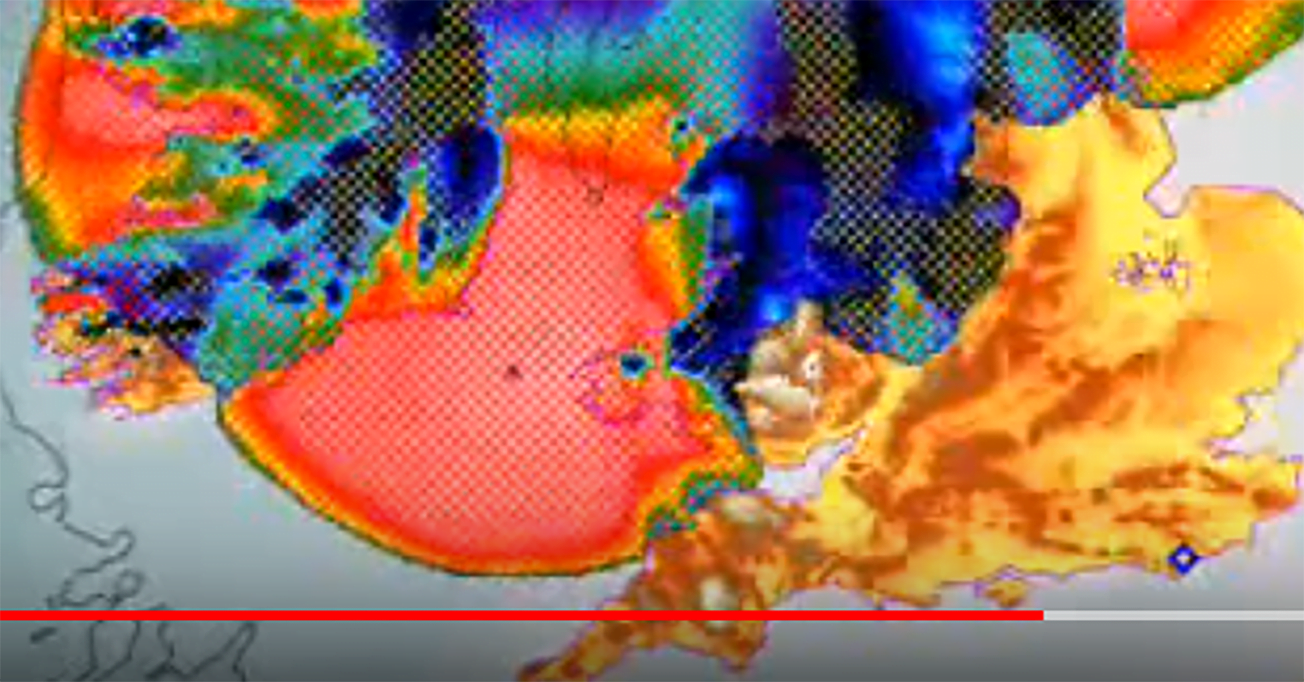
Google Earth map of North Yorkshire with a yellow traced outline of the Kinderscoutian sandstone around Brimham Rocks, red markers for the Devil's Arrows, Brimham Rocks and Plumpton Rocks, orange henge markers, and a blue polygon for the glacial lake reaching the Devil's Arrows.

Partisan. Say it up front. I think ice moved the big stones of Britain about and people stood them up, and I thought so before the geology got interesting. So read what follows as a man with a side and a map.

The occasion is a new paper on the Devil’s Arrows, the Millstone Grit monoliths beside the A1 at Boroughbridge, North Yorkshire. Put up something like 4,000 years ago (BC 2,000). The paper matches their zircons to Brimham Rocks, a crag 18 km west, and concludes that Bronze Age people picked that crag on purpose and dragged the stones eleven miles to a spot with no gritstone of its own. Deliberate sourcing. The word is in the title.

Google Earth map of North Yorkshire with a yellow traced outline of the Kinderscoutian sandstone around Brimham Rocks, red markers for the Devil's Arrows, Brimham Rocks and Plumpton Rocks, orange henge markers, and a blue polygon for the glacial lake reaching the Devil's Arrows.
Yellow: the Kinderscoutian sandstone the Arrows were matched to, traced from the BGS 1:50k map. Brimham Rocks is inside it, and so is a lot of other ground. Blue: the Devensian glacial lake, the Arrows on its west shore. The lake is rough, from the BGS Lexicon limits; the grit outline is raster-traced from a filtered BGS map image, not BGS vector data, and the filter picks one mapping name, so equivalent rock mapped under other names is left out. Contains British Geological Survey materials (c) UKRI 2026. Spin it round yourself in Google Earth.
Continue reading “Different special”

Stonehenge’s glacial till?

Artist first. Geology A level a distant third, and that was forty-five years ago. What follows was worked out in conversation with an AI, then checked against the documents. Where the checking ran out, I say so.

It is a reply to Brian John, who picked up my Glacial A303 post, and then answered a question I put to him. His answer changed what I think is worth asking for.

Map showing Trenches 511 and 512 north of the A303, west of Countess Roundabout, with Blick Mead and the River Avon to the south.
Two dots, back in the landscape. Trenches 511 and 512 lie beside the A303, west of Countess Roundabout, across the road from Blick Mead. The rings mark recorded trench locations, not trench outlines or the exact position of sample 51138. Map data © OpenStreetMap contributors.
Continue reading “Stonehenge’s glacial till?”

The glacial A303

They complained. Traffic past Stonehenge was glacial, they said, all because drivers slow down for a gawp at the stones. Little did they know. Four hundred and fifty thousand years ago the whole queue might have been sitting under an ice sheet.
Might. Hold on to that word; it does all the work in this post.

So they decided to build a tunnel. Under a UNESCO World Heritage Site. You cannot just dig; you have to check the buried history first. So they dug, and drilled, and augered, and trenched. Seven hundred times.

LiDAR relief image of rolling chalk downland with Stonehenge labelled and small coloured survey markers scattered across it
The survey area under LiDAR, gazetteer sites overlaid.
LIDAR: (c) Environment Agency copyright and/or database right 2026, Open Government Licence. Imagery (c) 2026 Google.

The picture above is the whole area under LiDAR, low sun from the north-west, every bump on Salisbury Plain standing to attention. The coloured squares are my gazetteer. Red for the primary records. Blue for trenches where the diggers wrote cold-climate words on their sheets. Grey for a line of auger holes, green for a 2023 evaluation by the visitor centre, purple for a borehole transect, orange for four drilled cores that went off to a laboratory and never came back. All of it lives in a Google Earth file you can spin round yourself. Turn the layers on and off. Fly about. It is the best free toy I have made all year.

I have read the lot. Forty-three public documents, 11,302 pages of borehole logs, trench sheets, laboratory appendices and method statements, put through a scanner with one question: ‘did anybody, anywhere along that road, record anything glacial?’ All from one road scheme, mind; Historic England’s own archive is another trawl for another day. What came back is not proof. Hints. But damn, some of them are suspicious.

Continue reading “The glacial A303”

Stonehenge’s stone 28

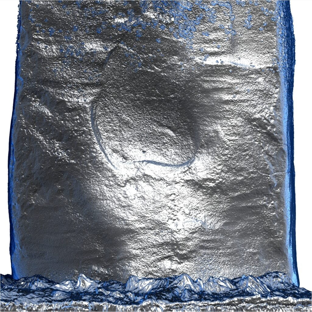
Long been fascinated by these carvings. I think this stone will be the Rosetta Stone of Stonehenge. Seen with other original markings on 59a and the back of 54. There’s definitely method in the carvers’ madness.

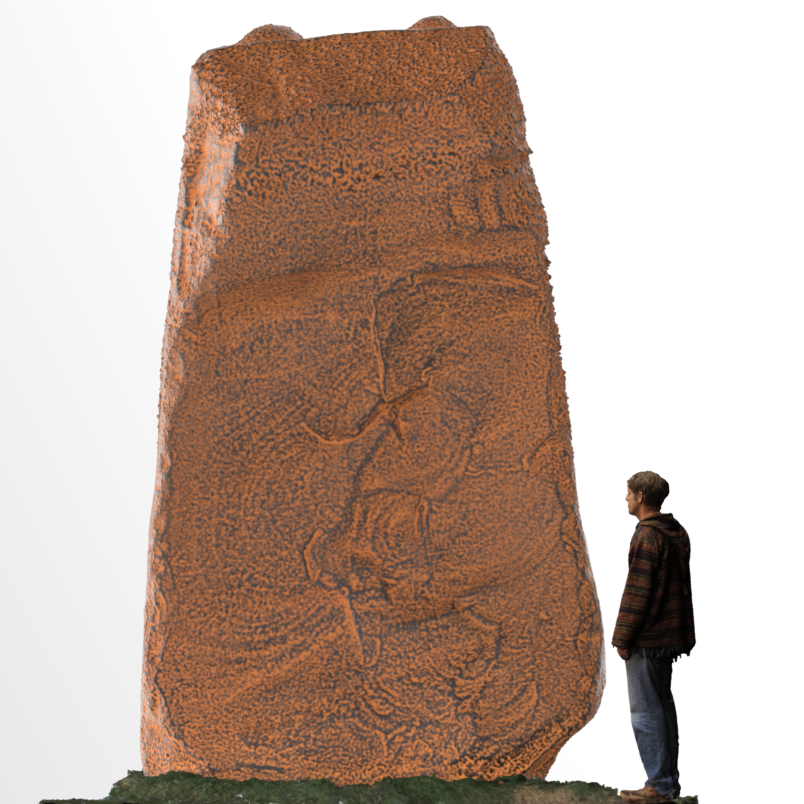
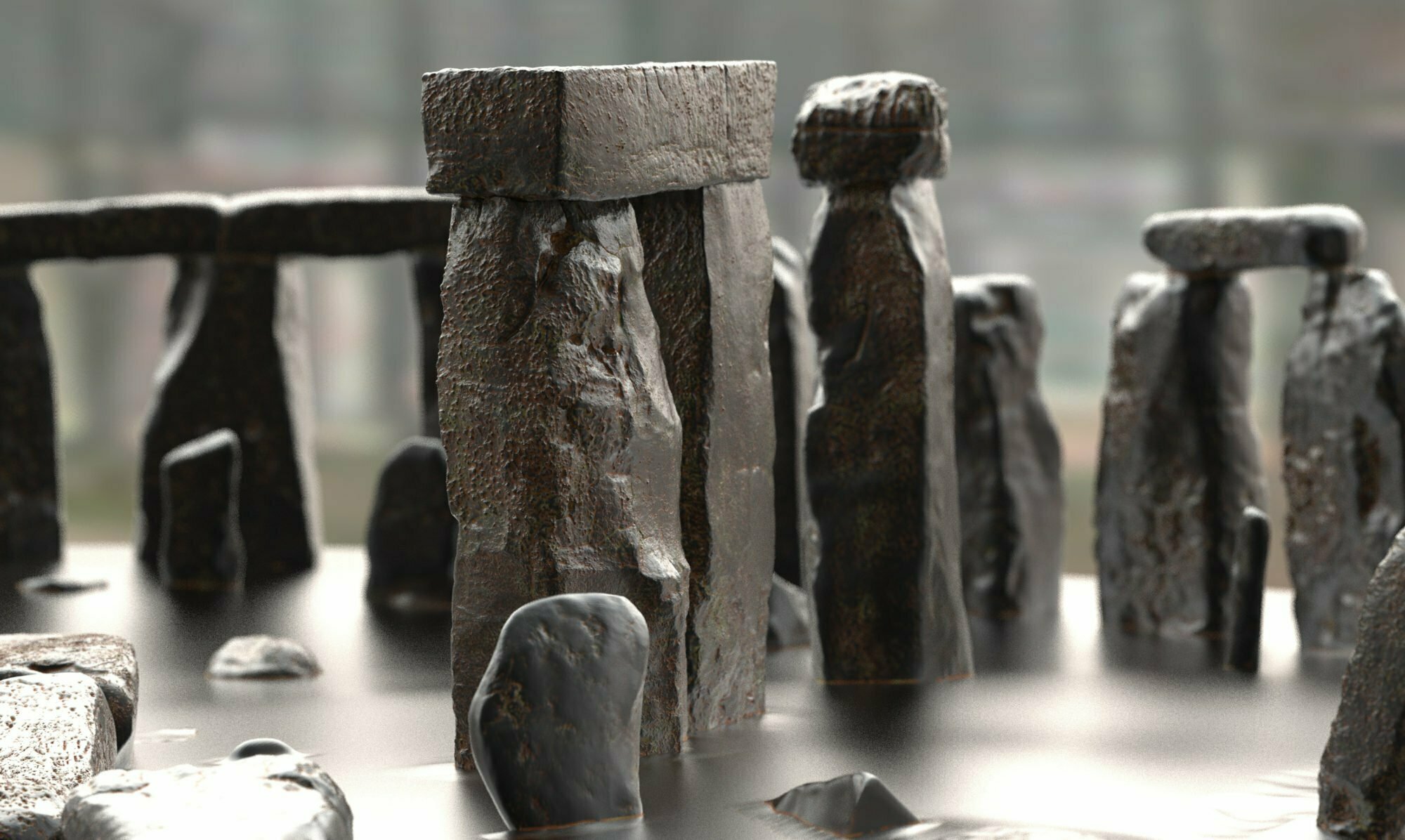
Stonehenge Stone 28 a sarsen on the outer ring showing the carved curves on the outer face of the stone. Rendered in a rust texture to emphasise the swirling patterns.
S28 rendered in a rust texture to emphasise the swirling patterns. Note the three notches top right.

Continue reading “Stonehenge’s stone 28”

Jōmon period v. Neolithic Britain

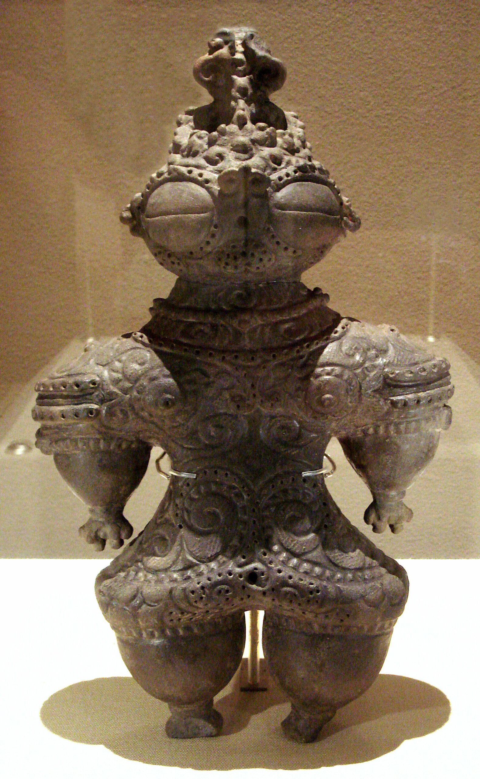
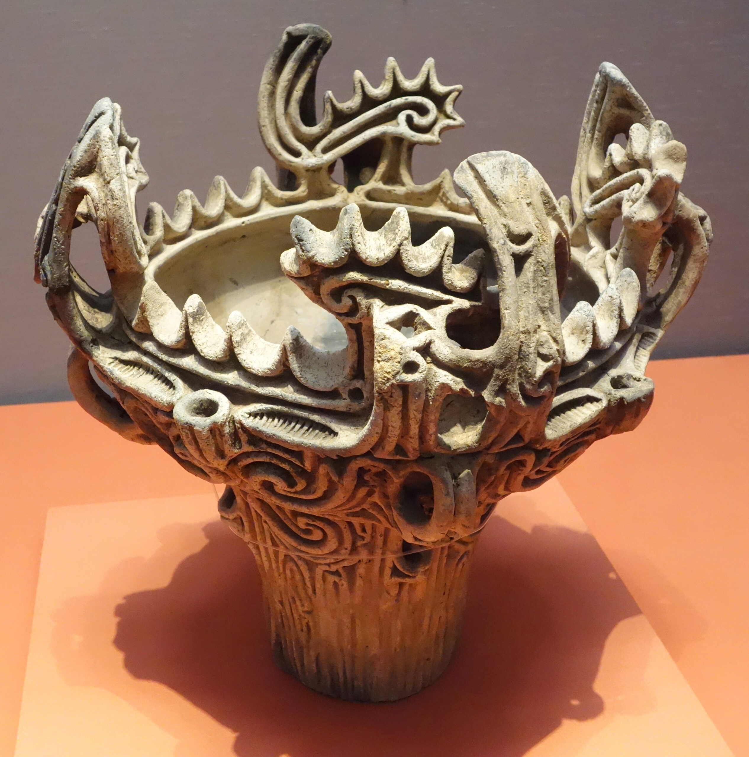
TIL about Japanese Dogū ceramic figures. Roughly same age as the sarsens of #Stonehenge. And Jōmon flame pottery, about the same age as the beginning of Stonehenge.

Via an exhibition at the Stonehenge visitor centre comparing British and Japanese Neolithic.

Continue reading “Jōmon period v. Neolithic Britain”

Fingerprinting Sarsens to West Woods

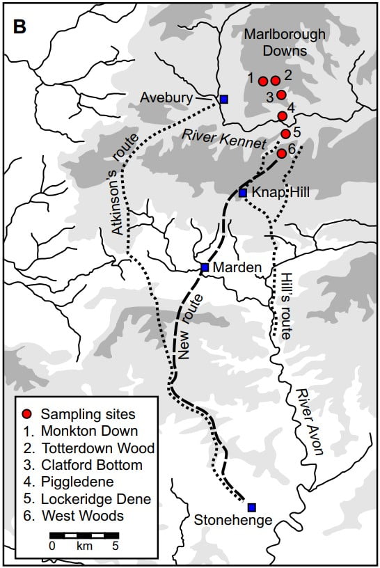
map of west woods the origin of the sarsens and routes to stonehenge

The fingerprinting of the sarsens of Stonehenge is fascinating. Though it took nearly three years and was a year late.


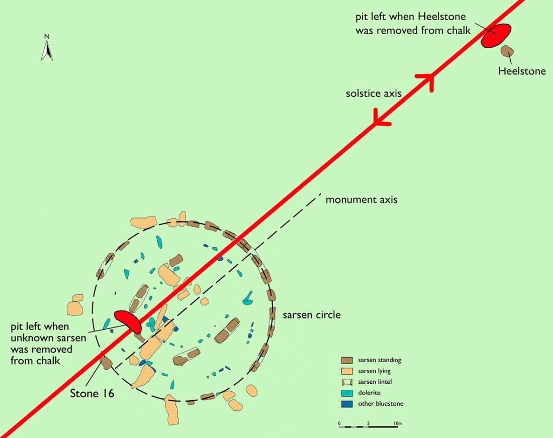
Seems that most of them are of the same type and probably from the same area. Even the Heel Stone! Which, as it is undressed and there’s a pit close by that it could have been pulled from, is surprising. As well, I thought there were at least two types of sarsen, orange and purple. But this seems to be unimportant — now.

Continue reading “Fingerprinting Sarsens to West Woods”

Durrington Shafts could be sarsen pits

Again, Brian John picks apart the ‘Durrington Shafts’ and points out that even the authors think that the northern arc is likely natural.


It pisses me off so much that the Stonehenge area has become so full of big junk science. It’s hard to get to the small truths.


Some of these holes (none are shafts) could well be sarsen extraction pits, which is far more important and has been ignored in this recent paper.

Continue reading “Durrington Shafts could be sarsen pits”